
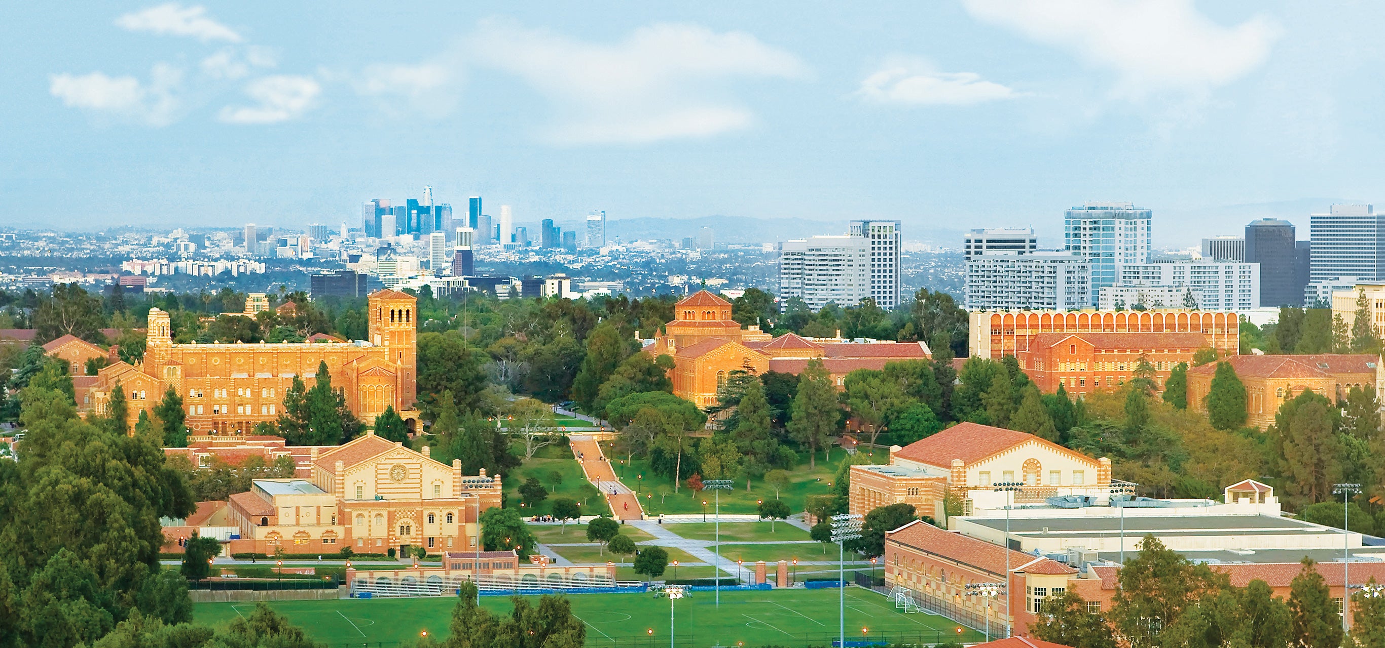
The University of California, Los Angeles (UCLA) is located in the Westwood neighborhood of West Los Angeles. The 419-acre campus is situated approximately five miles from the Pacific Ocean, positioned directly south of Sunset Boulevard and nestled between the affluent residential communities of Bel Air, Beverly Hills, and Brentwood.
The Precise Geographic Boundaries of the UCLA Campus
UCLA does not just exist within West Los Angeles; it serves as a primary anchor for the entire region. The campus is a self-contained environment, yet it is deeply integrated into the urban fabric of the city. To understand exactly where UCLA is located, one must look at the specific arterial roads that define its perimeter.
The northern boundary is defined by Sunset Boulevard, one of the most famous thoroughfares in the world. This section of Sunset separates the academic environment of the university from the hills of Bel Air. To the east, the campus is bordered by Hilgard Avenue, which transitions into the residential area of Holmby Hills and the western edge of Beverly Hills. The southern border is primarily marked by Le Conte Avenue, which acts as the gateway to the commercial district known as Westwood Village. Finally, the western boundary is defined by Veteran Avenue, which separates the campus from the West Los Angeles Federal Building and the neighborhood of Brentwood.
Within these boundaries, the campus is divided into several distinct "zones." The hilly terrain of the North Campus is characterized by older, Romanesque Revival architecture and houses the arts, humanities, and social sciences. In contrast, the South Campus is flatter and more modern, serving as the hub for the physical sciences, engineering, and the massive UCLA Health medical complex. Understanding this internal geography is vital for anyone trying to navigate the location, as "being at UCLA" can mean being blocks away from your actual destination depending on which gate you enter.
The Strategic Role of Westwood in the West Los Angeles Landscape
Westwood, the neighborhood housing UCLA, was specifically developed in the 1920s to complement the university. Today, in 2026, it remains one of the most vital economic and cultural corridors in Southern California. Its location is strategic, sitting halfway between the high-rise commercial centers of Downtown Los Angeles and the tech-heavy "Silicon Beach" areas of Santa Monica and Venice.
The relationship between the university and Westwood Village is symbiotic. The Village serves as the "college town" for UCLA, providing students and faculty with dining, shopping, and entertainment. However, because UCLA is located in such a high-value area of West Los Angeles, Westwood also caters to a global audience. It is home to historic cinema palaces like the Regency Village Theatre and the Bruin Theatre, which frequently host major Hollywood premieres due to their proximity to the major film studios.
Living in or visiting the area around UCLA provides a unique "Westside" experience. The air is notably cooler than in the San Fernando Valley or Inland Empire, thanks to the marine layer that frequently rolls in from the Pacific. The geography of the location also means that UCLA is situated on a gradual slope; as you move from the southern edge of the campus near Wilshire Boulevard toward the northern edge near Sunset, you gain significant elevation, offering glimpses of the Los Angeles basin and the ocean on clear days.

Campus Zones: North Campus vs. South Campus
To truly locate a specific department or facility within UCLA, you must understand the divide between North and South campus. This distinction is more than just geographic; it is a fundamental part of the university's identity and layout.
North Campus: The Cultural Core
The North Campus is the oldest part of the university. It is situated closer to Sunset Boulevard and is defined by iconic structures like Royce Hall and the Powell Library. This area is characterized by lush greenery, the Dickson Court sunken gardens, and the Murphy Sculpture Garden. If you are looking for the School of Theater, Film and Television, the School of Law, or the Luskin School of Public Affairs, you are heading to the northernmost section of the UCLA footprint. This area feels more like a traditional, secluded collegiate environment.
South Campus: The Scientific and Medical Powerhouse
The South Campus is located closer to the Westwood Village entrance and Wilshire Boulevard. This area is much more densely packed with modern laboratories, high-tech research facilities, and the sprawling Ronald Reagan UCLA Medical Center. The South Campus is home to the Henry Samueli School of Engineering and Applied Science, the Mathematical Sciences Building, and the Court of Sciences. Because this area is closer to the commercial district, it feels more industrial and fast-paced than the serene North Campus.
Accessibility and Transportation Hubs in 2026
Navigating to UCLA’s location in West Los Angeles has historically been a challenge due to the city’s infamous traffic. However, as of 2026, the transit landscape has evolved significantly. The university is located just east of the I-405 (San Diego Freeway), one of the busiest highway segments in the United States. Visitors typically access the campus via the Wilshire Boulevard or Sunset Boulevard exits.
The Metro D Line (Purple Line) Extension
A major shift for UCLA's location in 2026 is the progress of the Metro D Line Extension. This subway project is designed to connect Downtown LA to the Westside. The Westwood/UCLA station, located near the intersection of Wilshire and Westwood Boulevards, provides a high-capacity alternative to the gridlocked surface streets. This makes UCLA more accessible than ever for those traveling from the Eastside or the Miracle Mile district.
Local Bus Networks
UCLA is served by several major bus lines that make its West Los Angeles location highly reachable:
- Santa Monica Big Blue Bus: Offers extensive service between the UCLA campus and Santa Monica, Venice, and West Los Angeles.
- Culver City Bus: Connects the campus to the southern parts of the Westside, including Culver City and the Expo Line.
- LA Metro Bus: Provides rapid and local lines along Wilshire, Sunset, and Santa Monica Boulevards.
For those driving, UCLA utilizes a permit-based parking system with several large underground and multi-story structures (such as Structure 4, 7, and 8). Because the university is located in a high-density residential and commercial zone, street parking in the surrounding West Los Angeles neighborhoods is extremely limited and strictly enforced.
Proximity to Iconic West Los Angeles Landmarks
One of the reasons the "UCLA where is it located" query is so common is because the university is surrounded by so many other world-famous sites. Its position in West Los Angeles places it within a short drive (or a moderately long walk) of several key attractions.
| Landmark | Distance from UCLA | Relation to Campus |
|---|---|---|
| Westwood Village | 0.1 Miles | Directly adjacent to the southern campus boundary. |
| The Getty Center | 3.0 Miles | Visible from many North Campus buildings; located just across the 405. |
| Hammer Museum | 0.4 Miles | Located at the corner of Wilshire and Westwood Blvd. |
| Beverly Hills / Rodeo Drive | 2.5 Miles | Directly east via Wilshire or Santa Monica Boulevard. |
| Santa Monica Beach | 5.5 Miles | Directly west; reachable via a 20-minute drive down Wilshire. |
| Bel Air | 0.5 Miles | Located immediately north of the Sunset Blvd boundary. |
Being located in the heart of the Westside means UCLA is also near the "Federal Corridor," which includes the West LA Veterans Affairs (VA) Hospital and the Federal Building. This proximity creates a large zone of institutional and governmental activity that defines the character of the western edge of the campus.
The Impact of Topography on the UCLA Location
The physical location of UCLA is not flat. The campus was built on a series of rolling hills, which significantly impacts how people move through the space. The most famous example of this topography is the Janss Steps, a set of 87 steps that connect the lower athletic fields and student union area to the higher elevated "quad" of the original four buildings.
Because of this elevation change, the location offers unique microclimates. The North Campus often stays cooler and catchers more of the ocean breeze, while the South Campus, shielded by buildings and slightly lower in elevation, can feel warmer. The hilly nature of the site also means that many buildings have "ground floors" on multiple levels, which can be confusing for first-time visitors trying to find a specific room or office.
Practical Navigation for Visitors and Newcomers
If you are planning to visit UCLA, your "location" strategy should depend on your reason for visiting. Because the campus is so large, simply putting "UCLA" into a GPS may lead you to a gate far from your destination.
- For Prospective Students/Tours: You should aim for the UCLA Central Ticket Office or the Luskin Conference Center, typically accessed via Westwood Plaza from Le Conte Avenue.
- For Medical Appointments: Navigate specifically to the Ronald Reagan UCLA Medical Center at 757 Westwood Plaza. This is at the southernmost tip of the campus.
- For Athletic Events: The Pauley Pavilion and Drake Stadium are located on the western side of the campus, best accessed via Charles E. Young Drive West.
- For Arts and Performances: Royce Hall and the Fowler Museum are in the North Campus. It is best to enter via the Wyton Drive or Hilgard Avenue entrances on the east side.
The university employs a "color-coded" wayfinding system on many of its campus maps to help visitors distinguish between the different zones. Despite the density of West Los Angeles, the campus itself is heavily pedestrianized, with many of the central roads closed to general vehicular traffic to ensure student safety.
Living in West Los Angeles Near UCLA
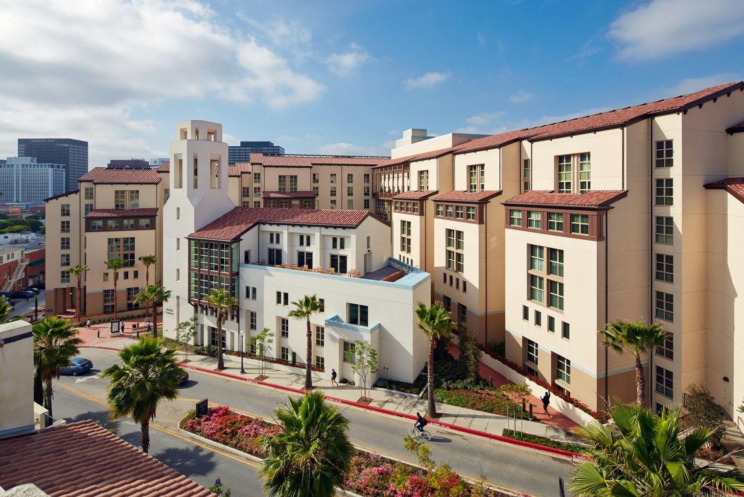
The location of UCLA significantly influences the local real estate and rental markets. To the immediate west of the campus lies "University Village," an area dominated by high-rise apartments and student housing. Further west, across Veteran Avenue, the neighborhood becomes more residential with a mix of mid-century modern homes and newer luxury developments in Brentwood.
To the east and north, the location borders some of the most expensive zip codes in the United States (90024, 90077, and 90210). This creates a stark contrast between the high-density student life of the campus and the quiet, gated estates of the surrounding hills. For faculty and staff, the location of UCLA in West Los Angeles necessitates a broad search for housing, often extending into Mar Vista, Culver City, or even parts of the San Fernando Valley, connected to the campus via the Sepulveda Pass.
Frequently Asked Questions
Is UCLA in a safe part of Los Angeles?
UCLA is located in one of the safest and most affluent areas of Los Angeles. The Westwood neighborhood is generally considered very safe for pedestrians, even at night. The university also maintains its own dedicated police department (UCPD) that patrols the campus and the immediate surrounding blocks 24/7. However, like any major urban center, standard safety precautions are recommended.
How far is UCLA from the airport?
UCLA is approximately 12 miles north of Los Angeles International Airport (LAX). In 2026, the drive can take anywhere from 30 minutes in light traffic to over an hour during peak commute times. The most direct route is usually taking the I-405 North and exiting at Wilshire Boulevard East.
Can I walk from UCLA to the beach?
While the Pacific Ocean is only about 5 miles away, it is a very long walk (roughly 1.5 to 2 hours) through hilly terrain and busy intersections. Most people prefer to take a short bus ride or bike down Santa Monica Boulevard or Wilshire Boulevard. There are dedicated bike lanes that make the trip to the Santa Monica Pier relatively straightforward for cyclists.
What is the closest major freeway to UCLA?
The closest freeway is the I-405 (San Diego Freeway). The campus sits just east of the 405. The I-10 (Santa Monica Freeway) is also nearby, located about 2 miles south of the campus, providing an east-west connection to Downtown LA and Santa Monica.
Where should I park if I am visiting UCLA for the first time?
For most visitors, Parking Structure 4 or Parking Structure 7 are the most convenient. They are centrally located and offer "Pay-by-Space" parking for those without a permit. Always check the UCLA Transportation website for current rates and availability, as parking can be limited during large campus events or mid-term weeks.
Final Recommendations for Navigating UCLA's Location
When visiting or researching UCLA's location in West Los Angeles, always distinguish between the "Academic Campus" and "Westwood Village." While they are adjacent, they offer very different experiences. If you are navigating by car, prioritize arriving via Wilshire Boulevard for the South Campus or Sunset Boulevard for the North Campus to avoid getting caught in the internal campus loop.
Utilize the 2026 expansion of the Metro D Line if you are coming from Central or East LA, as it eliminates the unpredictability of the 405 freeway. Finally, remember that UCLA is a walking campus; once you arrive at your designated parking or transit stop, be prepared to traverse several blocks of hilly terrain to reach your final destination.
Image Gallery
Select an image to open it in a new tab.




Celine Dubois
Contemporary Living and Global Arts Columnist
