Exploring Bolivia: How the Central Andes Shape the Geography, Climate, and Culture of South America

Bolivia sits in the central Andes of South America, shaping a high-altitude geography defined by massive mountain cordilleras, vast arid high plateaus, and deep tropical lowlands. This landlocked nation shares borders with Brazil, Peru, Chile, Argentina, and Paraguay, featuring dramatic ecological zones that span from freezing glacial peaks to humid Amazonian basins.
Geographical Positioning and the Andean Cordillera
The geographical identity of Bolivia is fundamentally tied to the Andes Mountains, which split into two primary chains—the Cordillera Occidental and the Cordillera Oriental—as they pass through the country. This dual-range formation cradles the Altiplano, a sprawling high-altitude plateau that sits at an average elevation of over 3,000 meters above sea level.
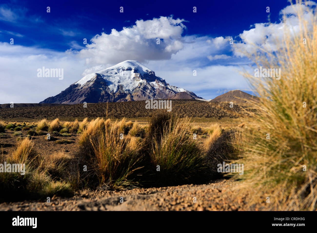
Within the Cordillera Occidental, which marks the natural border with Chile, volcanic peaks rise sharply. Mountains like the Nevado Sajama, Bolivia's highest peak standing at 6,542 meters, showcase the volcanic history of the region. Conversely, the Cordillera Oriental presents a more rugged, folded geological structure composed of sedimentary and metamorphic rock. This eastern range hosts iconic peaks such as Huayna Potosí and Illimani, both of which tower over the metropolitan expanse of La Paz.
The Altiplano itself is not a uniform plain. It is a basin of internal drainage split by the transverse range of the Cordillera de los Frailes and other highland knots. Water draining from the surrounding peaks feeds Lake Titicaca in the north—the highest navigable body of water in the world—and flows south into the shallower, hyper-saline Poopó basin and the vast salt flats of the Salar de Uyuni.
Climate Diversity Across Vertical Ecological Zones
Because Bolivia sits in the central Andes, its climate is heavily dictated by topography and elevation rather than latitude alone. The country is a textbook example of vertical zoning (pisos térmicos), where dramatic changes in temperature and precipitation occur over short horizontal distances as elevation changes.
The Altiplano and High Mountain Zones
The high-altitude regions experience cold, arid conditions. On the Altiplano, diurnal temperature ranges are extreme; daytime sun can push temperatures into comfortable ranges, but night temperatures frequently drop below freezing, especially during the dry winter months from May to August. Precipitation is scarce in the western Altiplano, increasing slightly toward Lake Titicaca, which acts as a thermal buffer moderating local temperatures. The high mountain peaks remain permanently snow-capped, hosting fragile glaciers that are sensitive to regional climate shifts.
The Inter-Andean Valleys (Yungas and Valles)
As the eastern slopes of the Andes descend toward the lowlands, they form deep, temperate valleys and subtropical transition zones known as the Yungas. These areas feature milder climates, high relative humidity, and abundant rainfall. The complex topography creates microclimates capable of supporting diverse agriculture, ranging from corn and fruit orchards in the higher valleys to coffee and coca in the humid middle slopes.
The Lowlands (Tierras Bajas)
East of the Andean foothills lie the tropical lowlands, encompassing the Amazon basin in the north and the Gran Chaco and Pantanal regions in the south and southeast. This zone experiences a tropical savanna or equatorial climate, characterized by high year-round temperatures and distinct wet and dry seasons. The wet season, running from roughly November to March, brings heavy tropical downpours that cause seasonal flooding across the vast grassy plains of the Llanos de Moxos.
| Ecological Zone | Elevation Range | Dominant Climate Type | Key Geographical Features |
|---|---|---|---|
| Puna & Altiplano | 3,600m – 6,500m+ | Cold, arid, alpine | Lake Titicaca, Salar de Uyuni, volcanic peaks |
| Valles & Yungas | 500m – 3,600m | Temperate to subtropical | Deep river canyons, terraced agriculture, cloud forests |
| Tierras Bajas (Lowlands) | 70m – 500m | Tropical, hot, seasonal rain | Amazonian rainforests, Llanos de Moxos, Gran Chaco |

Hydrological Systems and Major Basins
Water resources in Bolivia are distributed across three distinct hydrological basins, dictated by the Andean watershed divide. Understanding these systems is essential for comprehending the country's ecological balance and agricultural capacity.
The Amazon Basin
Covering roughly two-thirds of the national territory in the north and northeast, the Amazon drainage basin receives the vast majority of Bolivia's surface runoff. Major rivers such as the Beni, Mamoré, and Iténez flow northward through the tropical lowlands before converging to form the Madeira River, a major tributary of the Amazon River. These waterways serve as vital transportation corridors and sustain rich aquatic biodiversity, including freshwater dolphins and numerous fish species.
The Río de la Plata Basin
In the southern and southeastern parts of the country, water drains into the Río de la Plata basin via the Pilcomayo and Paraguay rivers. This region experiences a semi-arid to sub-humid climate, and its rivers are crucial for agricultural irrigation, cattle ranching, and cross-border water management with Argentina and Paraguay.
The Endorheic Basin (Altiplano Basin)
Unlike the Amazon and La Plata systems, the Altiplano is an inland drainage basin with no outlet to the sea. Precipitation and glacial meltwater collect in Lake Titicaca, drain south via the Desaguadero River into Lake Poopó, and eventually evaporate in the vast salt pans of Coipasa and Uyuni. Because this system is closed, it is highly vulnerable to evaporation rates, shifting precipitation patterns, and human water extraction.
Geological Riches and Mineral Heritage
The complex tectonic history that pushed the Andes skyward has also endowed Bolivia with vast mineral wealth. Mining has formed the backbone of the nation's economy and history for centuries, dating back to the pre-Columbian era and expanding massively during the Spanish colonial period with the legendary silver mines of Potosí.
Cerro Rico, the mountain overlooking the city of Potosí, yielded staggering amounts of silver that fueled the Spanish Empire. While silver extraction continues today, the mining sector has diversified significantly. Bolivia remains a major global producer of:
- Tin: Extracted primarily from the complex polymetallic veins of the eastern cordillera.
- Zinc and Lead: Often found alongside silver deposits in high-altitude mining districts such as Huanuni and Colquiri.
- Lithium: Concentrated heavily in the saline brines of the Salar de Uyuni, representing one of the world's largest untapped reserves of this critical energy-storage metal.
- Natural Gas: Found trapped in sedimentary rock formations beneath the Andean foothills and eastern lowlands, serving as a primary export commodity to neighboring South American countries.
Cultural and Demographic Adaptations to High-Altitude Living
Living in the central Andes has required profound physiological and cultural adaptations from Bolivia's population. Indigenous groups, notably the Quechua and Aymara nations, have inhabited the Altiplano and Andean valleys for millennia, developing agricultural techniques suited to high-altitude environments.
Traditional farming relies on indigenous crop varieties such as quinoa, cañahua, and multiple species of native potatoes that can withstand frost, poor soils, and intense ultraviolet radiation. Terracing (andenes) constructed along steep mountain slopes prevents soil erosion and optimizes solar exposure. Furthermore, the practice of freeze-drying potatoes into chuño allowed ancient Andean civilizations to store food securely for years, mitigating the risks of crop failure caused by unexpected freezes on the Altiplano.
Demographically, the high concentration of cities in the Andean highlands—such as La Paz, Oruro, and Potosí—contrasts with the fast-growing lowland economic hub of Santa Cruz de la Sierra. This geographic split has historically influenced political dynamics, infrastructure development, and cultural expressions across the nation.
Frequently Asked Questions
Why is Bolivia considered a landlocked country?
Bolivia lost its sovereign access to the Pacific Ocean following the War of the Pacific (1879–1884), in which it was defeated alongside Peru by Chile. Consequently, the country relies on international treaties and ports in neighboring nations, primarily Chile and Peru, for maritime trade and shipping.
What is the significance of the Salar de Uyuni?
The Salar de Uyuni is the world's largest salt flat, spanning over 10,000 square kilometers across the Altiplano. Formed from the evaporation of prehistoric lakes, it functions as a massive lithium reservoir and a unique geographic feature that attracts international tourism due to its mirror-like reflective properties during the rainy season.
How does high altitude affect travel in Bolivia?
Many of Bolivia's primary population centers and tourist destinations, including La Paz and Potosí, sit above 3,500 meters. Visitors frequently experience acute mountain sickness (soroche) due to lower atmospheric pressure and reduced oxygen availability. Gradual acclimatization, hydration, and local remedies like coca leaf tea are standard methods for managing symptoms.
What languages are spoken in Bolivia?
Bolivia recognizes Spanish as its primary official language, alongside 36 indigenous languages. Quechua, Aymara, and Guaraní are among the most widely spoken native tongues, reflecting the country's rich plurinational cultural heritage.
How has climate change impacted the central Andes of Bolivia?
Glacial recession is one of the most visible impacts of climate change in the Bolivian Andes. Smaller glaciers at lower elevations have shrunk dramatically over recent decades, reducing seasonal water supplies for agriculture, hydroelectric power generation, and urban consumption in cities like La Paz and El Alto.
Next Actions for Regional Research
For researchers, geographers, and travelers looking to explore the region further, examining specific geographical surveys from institutions such as the Servicio Geológico de Bolivia (SERGEOMIN) or regional hydrological assessments by the Andean Ecosystems Adaptation Project provides detailed technical data. Ensuring thorough preparation for high-altitude environments and understanding regional infrastructure limitations remain essential prerequisites for any field study or expedition into the central Andes.
TOPIC_METADATA: ["Bolivia Geography", "Central Andes", "Altiplano Climate", "South American Ecosystems"]
Image Gallery
Select an image to open it in a new tab.


Mateo Castillo
Decentralized Finance and E-Payments Strategist
