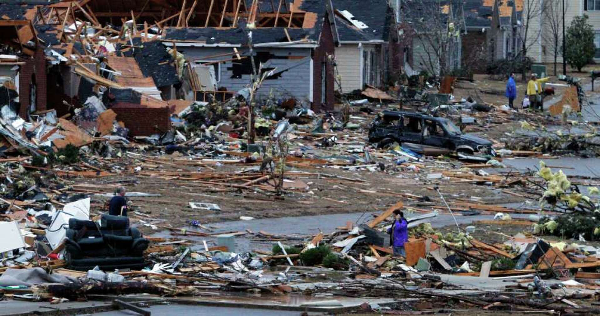
Tornadoes hit Alabama most frequently along two primary spatial tracks: the Northern Tennessee Valley corridor (spanning Huntsville, Decatur, and Cullman) and the Central Alabama transit zone (stretching through Tuscaloosa, Greater Birmingham, and Clanton). Understanding this geographic distribution matters because Alabama experiences an unusually high proportion of nocturnal tornadoes, dense forest cover obscuring funnels, and high structural exposure, making local hazard awareness vital for life safety and property resilience.
Alabama's Tornado Geography: High-Risk Zones and Spatial Patterns
Alabama resides in the heart of "Dixie Alley," a region of the Southeastern United States characterized by a higher frequency of strong, long-track, and deadly tornadoes compared to much of the central Great Plains. While severe weather can strike any portion of the state, historical climatology compiled by the NOAA Storm Prediction Center demonstrates that tornado paths cluster along distinct geographic belts influenced by regional terrain, atmospheric tracks, and seasonal Jet Stream positions.
- Tennessee Valley Zone (Huntsville • Decatur • Cullman • Limestone)
- Central Transit Corridor (Tuscaloosa • Birmingham • Shelby • Talladega)
- Southern & Coastal Region (Mobile • Baldwin • Wiregrass • Black Belt)
Northern Alabama and the Tennessee Valley
The northern tier of Alabama—encompassing Madison, Limestone, Morgan, Lawrence, Marshall, and Cullman counties—ranks among the most tornado-dense zones in the Southeastern United States. The terrain in this region transitions from the Cumberland Plateau into the flat river valley of the Tennessee River.
During the spring, mid-latitude troughs emerging from the central plains interact with Gulf moisture channeled northward. The low-level jet stream frequently aligns over North Alabama, generating intense low-level wind shear. Cities such as Huntsville and Cullman have experienced multiple high-intensity tornadic events, including long-track EF4 and EF5 tornadoes during major synoptic outbreaks.
The Central Alabama Corridor
Moving south, a high-frequency tornado belt extends from Pickens and Tuscaloosa counties eastward through Jefferson, Shelby, Bibb, Chilton, and St. Clair counties. This central corridor contains the state's major population centers, including the Tuscaloosa and Birmingham metropolitan areas.
The geographic positioning of central Alabama makes it vulnerable to discrete supercell development emerging from Mississippi. As severe storms cross the state line, they often encounter optimal instability (Convective Available Potential Energy, or CAPE) combined with strong directional shear. The resulting tracks frequently trace northeastward paths along regional river valleys and ridge structures, such as the Appalachian foothills, maintaining intensity over dozens of miles.
Southern Alabama and Coastal Severe Weather
Southern Alabama, including Mobile, Baldwin, Escambia, and the Wiregrass region (Dothan and Houston County), exhibits a distinct tornadic profile. While long-track EF4 or EF5 tornadoes are less frequent in the southern third of the state than in the north, the overall frequency of short-lived EF0 to EF2 tornadoes remains high.
Tornadic activity in coastal and southern Alabama stems from two main drivers:
- Cool-Season Low-CAPE/High-Shear (HSLC) Systems: Winter atmospheric setups where strong dynamics compensate for limited thermodynamic instability.
- Tropical Cyclone Touchdowns: Spiral rainbands from Gulf Coast hurricanes and tropical storms, which produce rapid, localized tornadic spinning in the forward-right quadrant of the landfall zone.
Understanding Dixie Alley: Meteorological Drivers in Alabama
To understand why Alabama experiences severe tornadoes, it is necessary to contrast the regional atmospheric mechanics of Dixie Alley with the classic Great Plains Tornado Alley.
- Gulf of Mexico (Warm, Ultra-Moist Air) + Jet Stream & Cold Front (Strong Low-Level Shear & Upper Dynamics)
- High Risk Tornado Environment
- High helicity at low altitudes (0-1 km)
- Lower lifting condensation levels (cloud bases near ground)
- Fast storm motion (50–70 mph translate speeds)
- High Risk Tornado Environment
Atmospheric Dynamics: Moisture and Shear
In the Great Plains, tornado formation often relies on a pronounced boundary known as the "dryline," separating moist air from dry desert air. In Alabama, tornadoes rarely depend on a dryline. Instead, severe weather in the state is driven by low-level moisture streaming directly off the warm Gulf of Mexico, maintaining high boundary-layer dew points (often exceeding 65°F to 70°F).
When this unstable air mass encounters deep upper-level troughs and a powerful low-level jet stream (winds operating within 1 kilometer of the surface), the resulting atmospheric shear causes storms to rotate. In many Alabama outbreaks, low-level storm-relative helicity (SRH)—a measure of potential storm rotation—reaches extreme levels, allowing supercells to generate tornadoes even under modest thermal instability.
Seasonal Peaks: Dual Severe Seasons
Unlike regions with a single mid-summer severe weather window, Alabama experiences two distinct peak severe weather periods:
- Spring Peak (March through May): This primary season produces the state's most destructive, long-track EF3 to EF5 tornadoes. It occurs as powerful spring low-pressure systems push cold fronts across the Deep South, colliding with rich tropical air masses.
- Autumn/Early Winter Secondary Peak (November through December): As the Jet Stream shifts southward in late autumn, cold polar air masses begin pushing into warm Gulf moisture across Alabama. This secondary season frequently yields fast-moving Quasi-Linear Mesoscale Systems (QLCS), commonly known as squall lines, capable of producing embedded tornadoes at night.
Why Geographic and Climatological Factors Matter in Alabama
The geographic pattern of tornadoes in Alabama matters because physical, atmospheric, and sociological factors combine to elevate the risk to human life and physical property higher than in many other parts of the country.
- Alabama Tornado Vulnerability
- Nocturnal Events: High proportion occurring overnight; warnings miss sleeping populations.
- Visual Obscuration: Dense pine/hardwood forests and hilly terrain block visual funnel identification.
- Housing Exposure: High concentration of manufactured homes & unreinforced structures.
The Threat of Nocturnal Tornadoes
A major safety challenge in Alabama is the high occurrence of nocturnal tornadoes—storms that form or persist after dark. Research published by the American Meteorological Society indicates that the Mid-South and Deep South experience a significantly higher proportion of nighttime tornadoes than the central plains.
Nighttime tornadoes are disproportionately deadly for several key reasons:
- Visual Identification Failure: Spotters and residents cannot visually confirm a tornado approach in the dark.
- Sleeping Populations: Warnings issued between 10:00 PM and 6:00 AM frequently fail to wake sleeping residents who rely solely on outdoor warning sirens or silenced mobile phones.
- Fast Translation Speeds: Autumn and winter nocturnal storms in Alabama often travel at translation speeds between 50 and 70 mph, drastically reducing lead time between warning issuance and impact.
Topography, Forest Cover, and Visual Blockage
In the open prairie of Kansas or Oklahoma, tornadoes are often visible from miles away, providing early visual cues to residents. In Alabama, the physical landscape works against visual detection:
- Dense Canopy Cover: Alabama features extensive pine and hardwood forests. Trees obscure horizons and block views of approaching cloud bases.
- Complex Topography: The Appalachian foothills, plateaus, and river valleys in northern and central Alabama create terrain contours that obscure low-level storm features.
- Rain-Wrapped Structures: Severe supercells in high-moisture environments frequently wrap tornadoes in heavy precipitation, rendering the funnel invisible until impact.
Demographic Vulnerability and Housing Stock
The impact of a tornado depends on both its intensity and the vulnerability of the structures it strikes. Alabama has a large distribution of manufactured homes and unreinforced single-family structures, particularly across rural counties in the Black Belt, central corridor, and northern valleys.
Manufactured housing, even when anchored according to basic HUD standards, provides minimal structural integrity against EF2 or stronger tornadoes. When tornadic tracks cross areas with high manufactured home density, casualties increase significantly compared to impacts on reinforced frame structures.
Historic Alabama Outbreaks: Spatial and Meteorological Comparison
Historical data highlights how specific geographic corridors in Alabama absorb repeated major severe weather events. The table below compares notable tornado outbreaks across key Alabama regions, illustrating differences in storm tracks, intensity, and historical impact.
| Outbreak / Event | Primary Regional Impact | Max EF/F Scale | Key Spatial Characteristics | Meteorological Context |
|---|---|---|---|---|
| Super Outbreak of April 27, 2011 | Statewide (Northern & Central Focus: Tuscaloosa, Birmingham, Phil Campbell, Hackleburg, Cullman) | EF5 | Dozens of long-track, wedge tornadoes traversing 50 to 100+ miles across ridge-and-valley terrain. | Historic outbreak with extreme CAPE (>3,000 J/kg) and extreme low-level helicity driven by a violent upper-level trough. |
| Super Outbreak of April 3–4, 1974 | Northern Alabama (Limestone, Madison, Morgan, Lawrence, Cullman Counties) | F5 | Multiple parallel long-track F4 and F5 funnels moving northeast through the Tennessee Valley. | Strong classic spring outbreak featuring deep low pressure moving through the Ohio Valley with strong shear across the South. |
| Enterprise Tornado (March 1, 2007) | Southern Alabama (Coffee County / Enterprise) | EF4 | Concentrated localized track striking structural assets (Enterprise High School). | Early-season supercell development interacting with a warm front advancing north from the Gulf Coast. |
| Beauregard Tornado (March 3, 2019) | East-Central Alabama (Lee County / Beauregard) | EF4 | Long-track EF4 tornado traveling over 68 miles across Alabama and Georgia. | High-shear, modest-instability environment that yielded intense localized stretching and violent vortex strength. |
| Christmas Week Outbreak (Dec 23–25, 2015) | Central & Northern Alabama | EF2 | Multiple nocturnal, fast-moving tracks embedded in squall lines and isolated mini-supercells. | Unusually warm, moist winter air mass creating a classic secondary season severe setup. |
Structural Resilience and Preparedness: Turning Risk Awareness into Action
Given the recurring geographic paths and atmospheric characteristics of Alabama tornadoes, property owners, local governments, and builders must implement specific mitigation strategies to reduce risk.
Building Standards and IBHS FORTIFIED Roof Specifications
Roof failure is the primary trigger for catastrophic building collapse during a high-wind event. When wind lifts the roof structure, exterior walls lose lateral support and collapse outward.
To combat this, the Insurance Institute for Business & Home Safety (IBHS) established the FORTIFIED Home™ standard, which has seen widespread adoption across Alabama. Key structural enhancements include:
- Ring-Shank Nails: Replacing smooth nails with ring-shank nails doubles the resistance against roof sheathing uplift.
- Sealed Roof Deck: Applying self-adhering polymer-modified bitumen tape over sheathing joints prevents water entry even if shingles fall off.
- Enhanced Edge Metal: Heavy-gauge drip edges anchored with tight fastener spacing stop wind from peeling back shingles at the roof perimeter.
- Continuous Load Path: Installing engineered metal hurricane straps or tie-downs connecting roof trusses down through framing to the concrete foundation.
- Roof Decking
- Ring-Shank Nails & Sealed Deck Joints
- Exterior Walls
- Engineered Hurricane Straps / Structural Sheathing
- Foundation
- Anchor Bolts Set into Reinforced Concrete
Safe Room Engineering and Shelter Guidelines
Because standard home construction cannot withstand EF4 or EF5 winds, structural shelters engineered to FEMA P-320 guidelines or ICC 500 standards provide the absolute minimum standard for surviving violent tornadoes.
Requirements for compliant safe rooms in Alabama include:
- Structural Independence: Below-ground shelters or reinforced above-ground safe rooms must be structurally isolated from the surrounding house frame to remain intact if the outer home collapses.
- Impact Resistance: Door assemblies must pass missile impact tests (withstanding a 15-pound 2x4 lumber board shot at 100 mph) to prevent penetration by windborne debris.
- Anchor Depth: Above-ground concrete or steel safe rooms must be anchored to a reinforced concrete slab of sufficient mass and depth to resist extreme overturning moments.
Dual-Redundancy Emergency Warning Systems
Relying on a single notification method is a primary failure point during nocturnal Alabama severe weather events. Residents should maintain a dual-redundancy alert setup:
- Primary Nocturnal System: An NWR (NOAA Weather Radio) with Specific Area Message Encoding (SAME) technology set to loud audible alarm mode. These units run on grid power with battery backup, ensuring operation during power outages.
- Secondary Digital Alerts: Wireless Emergency Alerts (WEA) enabled on mobile devices, paired with location-based severe weather alerting applications configured to override "Do Not Disturb" modes during Tornado Warnings.
- Avoid Siren Reliance: Outdoor warning sirens are designed only to alert individuals who are outdoors. They are not engineered to penetrate modern insulation and wake indoor residents at night.
Frequently Asked Questions
Why does Alabama experience more tornado fatalities than some Central Plains states?
Alabama experiences higher tornado mortality due to a combination of meteorological and socio-demographic factors: a high percentage of tornadoes occur at night, dense forests conceal approaching funnels, high translation speeds limit lead times, and there is a high concentration of mobile and manufactured homes across rural areas.
What is the difference between Tornado Alley and Dixie Alley?
Tornado Alley (spanning Texas, Oklahoma, Kansas, and Nebraska) sees peak activity in late spring, mostly during daytime hours, driven by dryline boundaries in open terrain. Dixie Alley (covering Alabama, Mississippi, Tennessee, and Georgia) features two peak seasons (spring and late autumn), high atmospheric moisture, lower cloud bases, faster storm translation speeds, dense tree cover, and a high rate of nighttime tornadoes.
Where is the safest place to be during an Alabama tornado if I do not have a storm shelter?
If a shelter or safe room is unavailable, move immediately to the lowest level of a sturdy, permanent building. Position yourself in a small interior room near the center of the structure—such as a hallway, bathroom, or closet—away from exterior walls and windows. Cover yourself with mattresses, heavy blankets, or a helmet to protect against falling and flying debris.
Are outdoor weather sirens reliable for tornado warnings in Alabama homes?
No. Outdoor warning sirens are designed solely to notify people who are outside in parks, fields, or open areas. They are not designed to penetrate building insulation, double-pane glass, or wake sleeping individuals inside homes at night. Residents should rely on NOAA Weather Radios and emergency smartphone alerts instead.
Can severe tornadoes hit mountainous or hilly areas in North Alabama?
Yes. Topography does not stop or divert tornadoes. Violent tornadoes routinely cross steep hills, plateaus, and river valleys across Northern and Central Alabama. In the April 27, 2011 outbreak, EF4 and EF5 tornadoes maintained destructive power as they tracked across high ridges and deep valleys throughout the Appalachian foothills.
Practical Recommendations for Alabama Residents and Property Owners
Understanding where tornadoes strike in Alabama is only the first step; taking targeted action reduces structural risk and protects household safety:
- Verify Your Local Risk Profile: Determine whether your property sits within high-density transit corridors, such as the Tennessee Valley or the Central Alabama belt, to evaluate structural reinforcement needs.
- Upgrade Structural Components: If constructing or reroofing a property, mandate IBHS FORTIFIED Home™ standards. Ensure your roofing contractor uses ring-shank nails, sealed roof deck tape, and heavy-gauge edge flashing.
- Establish a Dedicated Safe Space: Install a FEMA P-320 compliant storm shelter or designate an interior room on the lowest floor. Stock this space with helmets, sturdy boots, flashlight units, and a portable emergency kit.
- Deploy Dual Emergency Warnings: Program a NOAA Weather Radio with your county's SAME code and verify that WEA emergency alerts are active on all household mobile phones. Never rely on outdoor sirens while indoors.
- Develop a Mobile Home Evacuation Plan: If you reside in a manufactured or mobile home, identify a sturdy shelter, community safe room, or nearest permanent structure in advance. Evacuate to that location immediately when a Tornado Watch is issued for your area.
Image Gallery
Select an image to open it in a new tab.
Simon Caldwell
Enterprise Technology and Systems Editor
