
The Eastern Pacific Ocean is currently experiencing significant shifts in sea surface temperatures and atmospheric circulation patterns, driven by the complex interaction of the El Niño-Southern Oscillation (ENSO) and broader anthropogenic climate trends. These changes directly influence regional rainfall, marine ecosystem health, and the intensity of seasonal storms affecting both coastal nations and global climate teleconnections.
The Dynamics of the Eastern Pacific Climate System
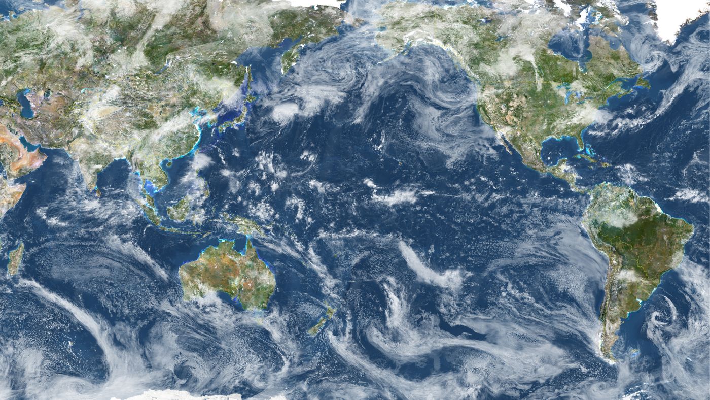
The Eastern Pacific Ocean, specifically the region extending from the coast of the Americas toward the International Date Line, acts as a primary heat engine for the planet. The weather in this region is primarily governed by the Walker Circulation—a massive atmospheric loop where warm air rises over the Western Pacific and descends over the Eastern Pacific. When this balance shifts, the consequences are felt far beyond the ocean surface.
In recent years, observations from the National Oceanic and Atmospheric Administration (NOAA) have highlighted that the Eastern Pacific is undergoing a state of heightened volatility. The primary drivers are the fluctuations in sea surface temperatures (SSTs) that dictate whether the region enters an El Niño or La Niña phase. However, as of 2026, researchers are increasingly focused on how "background" oceanic warming is altering the baseline of these events, potentially making extreme weather patterns more persistent than historical models predicted.
The Role of Sea Surface Temperatures
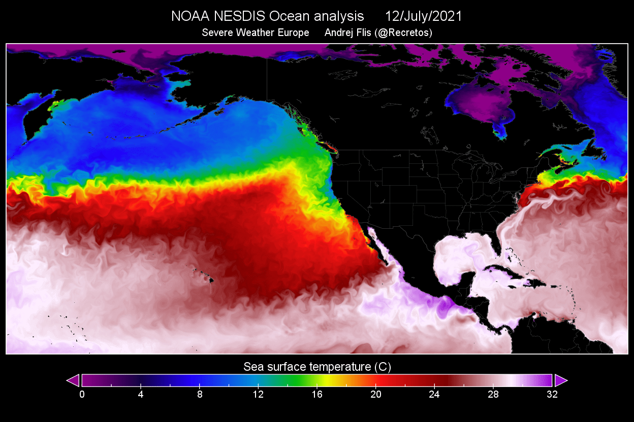
Sea surface temperature is the single most critical variable in predicting Eastern Pacific weather. When waters off the coast of South America warm significantly—a phenomenon known as El Niño—the atmospheric pressure patterns shift eastward. This shift typically brings higher rainfall to the arid regions of Peru and Ecuador while simultaneously suppressing hurricane activity in the Atlantic but intensifying it in the Central and Eastern Pacific basins.
Conversely, the cooling associated with La Niña events strengthens the trade winds, pushing warmer surface waters toward the Western Pacific and causing a "cold tongue" to develop across the Equatorial Eastern Pacific. This creates a cascade of effects, often leading to drought conditions in the Southern United States and Mexico, while changing the migratory paths of marine species that rely on specific thermal niches to survive.
Meteorological Impacts on Coastal Communities
The changing weather in the Eastern Pacific has tangible consequences for the nations bordering this basin. As of 2026, these impacts are no longer theoretical; they are integrated into the disaster preparedness and economic planning of coastal regions.
Shifting Precipitation Patterns
The most immediate impact of shifting Pacific weather is the disruption of established rainfall seasons. In the Eastern Pacific, moisture-laden air masses often determine the success of agricultural cycles in Central America and the Pacific coast of South America. When the Pacific jet stream moves, it can starve regions of necessary rainfall or dump excessive amounts in a short period, leading to flash flooding and landslides.
Marine Ecosystem Disruptions
The ocean does not simply mirror the weather; it is an active participant. The Eastern Pacific is home to some of the most productive fisheries in the world, sustained by the upwelling of nutrient-rich, cold deep-ocean water. As surface temperatures remain elevated or fluctuate unpredictably, the depth of the thermocline—the transition layer between warm surface water and cold deep water—changes. This prevents nutrient upwelling, leading to "marine heatwaves" that can decimate local fish populations and the economies that depend on them.
Comparative Overview of Pacific Weather Phases
Understanding the distinction between climate phases is essential for interpreting weather reports and long-term forecasts. The following table outlines the general characteristics associated with primary Pacific oscillations as they pertain to the Eastern Pacific region.
| Feature | El Niño (Warm Phase) | La Niña (Cold Phase) | Neutral Conditions |
|---|---|---|---|
| SST Anomalies | Higher than average in Eastern Pacific | Lower than average in Eastern Pacific | Near historical averages |
| Trade Winds | Weakened or reversed | Strengthened | Normal intensity |
| Regional Rainfall | Increased in coastal Peru/Ecuador | Decreased in coastal South America | Seasonal norms |
| Storm Frequency | Higher hurricane activity in Pacific | Higher activity in Atlantic/Caribbean | Variable |
| Nutrient Supply | Restricted (reduced upwelling) | Enhanced (robust upwelling) | Balanced |
Technical Challenges in Forecasting 2026 Weather
Modern meteorological forecasting for the Eastern Pacific relies on a combination of satellite remote sensing, autonomous underwater vehicles (AUVs), and sophisticated global climate models (GCMs). Despite these advancements, the region remains notoriously difficult to forecast with absolute precision due to the lack of dense observation stations in the open ocean.
The Problem of Data Sparsity
While satellites provide excellent coverage of surface temperature, they cannot fully "see" the depth of the water column. The temperature at 100 meters below the surface is often a better predictor of an impending El Niño than the surface temperature itself. In 2026, the reliance on the Tropical Atmosphere Ocean (TAO) array of moored buoys remains a critical, yet fragile, component of early warning systems. Maintenance of these buoys is expensive and logistically challenging, leading to gaps in data that can cloud long-range forecasts.
Anthropogenic Forcing and Signal Noise
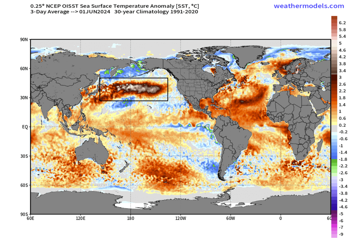
A significant challenge for climate scientists today is distinguishing between natural variability—the "noise" of the weather—and the underlying "signal" of long-term climate change. The Eastern Pacific is experiencing a rise in baseline temperatures that complicates traditional definitions of El Niño and La Niña. Some scientists argue that we are entering an era where "neutral" years are now as warm as historic "El Niño" years, effectively shifting the baseline for what constitutes a weather anomaly.
How Communities and Industries Adapt
Given the volatility of the Eastern Pacific, local governments and global shipping industries have adopted proactive strategies. These include:
- Improved Early Warning Systems: Governments are investing in localized radar networks to better predict the arrival of storms and heavy rainfall in real-time, moving away from reliance on general monthly climate outlooks.
- Adaptive Fisheries Management: By monitoring subsurface temperature data, fishery managers can now issue temporary closures or adjust catch quotas when they identify conditions that threaten the survival of juvenile fish stocks.
- Infrastructure Hardening: Coastal cities are prioritizing drainage infrastructure that can handle the "peak load" of intense, climate-induced rainfall events, which occur more frequently than previous engineering standards suggested.
Frequently Asked Questions
Is the Eastern Pacific currently in El Niño or La Niña?
As of 2026, climate conditions are determined by the most recent seasonal cycle. You should consult the official monthly Climate Diagnostics Bulletin provided by the Climate Prediction Center (CPC) to view the current Oceanic Niño Index (ONI). This index confirms the official state of the Pacific based on a rolling three-month average of sea surface temperatures in the Niño 3.4 region.
How do changes in the Pacific affect the global economy?
The Pacific climate acts as a pivot for global weather. When the Eastern Pacific is unusually warm or cold, it affects the jet streams, which in turn impacts agricultural output in the United States, Brazil, and Australia. A significant weather event in the Pacific often leads to shifts in global commodity prices for grains, sugar, and soy, as global markets react to expected supply changes.
Are hurricanes becoming more common in the Eastern Pacific?
There is evidence suggesting that the spatial distribution of hurricanes is shifting. While the total number of storms may not be increasing exponentially, the intensity of storms in the Eastern Pacific often correlates with warmer sea surface temperatures. Storms that do form are more likely to reach higher categories more rapidly due to increased heat content in the upper ocean layers.
Where can I find reliable, real-time data on Pacific conditions?
For verified, scientific data, you should access the National Oceanic and Atmospheric Administration (NOAA) Pacific Marine Environmental Laboratory (PMEL) website. They provide open-access data from the TAO/TRITON buoy array, which is the gold standard for monitoring the temperature and wind conditions of the tropical Pacific.
How far in advance can we accurately predict Eastern Pacific changes?
Current statistical and dynamical models provide skillful predictions for ENSO conditions approximately 6 to 9 months in advance. Beyond this timeframe, the "predictability barrier" increases, making long-term projections (12+ months) less reliable.
Recommendation for Next Steps
If you are involved in industries sensitive to Pacific weather, such as agriculture, maritime logistics, or environmental research, do not rely on generalized media reports. Instead, establish a routine of reviewing the NOAA ENSO Blog and the Climate Prediction Center’s monthly technical briefings. These resources provide the nuance required to understand whether a developing trend is a standard seasonal fluctuation or a persistent, structural change in the Eastern Pacific environment. By tracking the subsurface temperature anomalies alongside surface data, you can achieve a more sophisticated understanding of the risks and opportunities presented by our changing climate.
Image Gallery
Select an image to open it in a new tab.
Omar Farooq
EdTech Innovation and Virtual Pedagogy Journalist
