Understanding Avalanche Risks in British Columbia: A Comprehensive Safety Guide for 2026

To navigate the mountains of British Columbia safely, you must monitor the daily forecasts provided by Avalanche Canada, carry essential rescue gear (transceiver, probe, and shovel), and complete at least an Avalanche Skills Training (AST 1) course. Avalanche risk in BC is a result of complex interactions between the province's diverse maritime and continental snowpacks and its steep, rugged terrain.
British Columbia is globally renowned for its vast mountain ranges, deep powder, and world-class backcountry access. However, this same geography makes it one of the most active avalanche regions in North America. Whether you are a backcountry skier, a snowmobiler in the Revelstoke area, or a snowshoer on the North Shore mountains, understanding the mechanics of an avalanche in British Columbia is a prerequisite for survival. As of 2026, safety protocols have become more sophisticated with integrated technology, but the fundamental risks of the mountain environment remain as potent as ever.
The Geography of Risk: BC’s Diverse Snow Climates
British Columbia’s avalanche landscape is not uniform; it is divided into three distinct "snow climates." Understanding which climate you are entering is the first step in risk assessment.
The Maritime Climate (Coast Mountains)
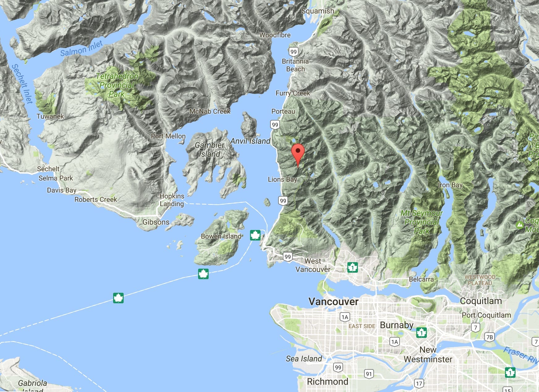
The Coast Mountains, including the ranges near Vancouver, Whistler, and Terrace, are characterized by heavy, wet snowfall and relatively mild temperatures. In this region, the snowpack tends to stabilize quickly after a storm. However, the sheer volume of snow can create massive "direct action" avalanches during or immediately after a storm. Rain-on-snow events are also common here, which can rapidly destabilize the entire snowpack.
The Continental Climate (The Rockies)
On the eastern edge of the province, the Canadian Rockies experience a continental climate. This means colder temperatures and much less snowfall than the coast. While the snow is lighter and deeper for skiing, it is often more dangerous. The thin snowpack is prone to developing "facets"—weak, sugary crystals that do not bond well. This leads to persistent weak layers that can remain reactive for months, making it difficult to predict when a slope might slide.
The Transitional Climate (The Columbias and Selkirks)
The Interior ranges, such as the Monashees, Selkirks, and Purcells (often called the "Powder Highway"), sit in a transitional zone. This area experiences the high snowfall of the coast but the temperature fluctuations of the interior. It is infamous for "buried surface hoar"—feathery crystals that form on the surface during cold, clear nights and are then buried by the next storm, creating a hidden "house of cards" within the snowpack.
Avalanche Canada: Your Primary Resource in 2026
Avalanche Canada (AvCan) remains the gold standard for public safety information. Based in Revelstoke, this non-government organization coordinates forecasting for the entire province. For 2026, their digital infrastructure has expanded to provide high-resolution, terrain-specific data that integrates user-submitted reports with professional observations.
Reading the Daily Forecast
The Daily Avalanche Forecast is the most critical document for anyone heading into the BC backcountry. It utilizes the North American Public Avalanche Danger Scale, which ranges from 1 (Low) to 5 (Extreme).
- Low (1): Generally safe, but watch for isolated unstable areas.
- Moderate (2): Heightened tension on specific terrain features. Features can be triggered by human weight.
- Considerable (3): Dangerous conditions. Natural avalanches are possible; human-triggered ones are likely. This is the rating where the most fatalities occur because the terrain often looks "safe enough" to the untrained eye.
- High (4): Very dangerous. Large natural avalanches are certain. Travel in avalanche terrain is not recommended.
- Extreme (5): Avoid all avalanche terrain. Large to very large avalanches are certain and may run into valley bottoms.
The Mountain Information Network (MIN)
A vital component of the 2026 safety ecosystem is the Mountain Information Network. This is a crowd-sourced platform where backcountry users upload photos and descriptions of snow conditions, avalanches seen, and "whoomping" sounds (the sound of a collapsing snow layer). In a province as large as BC, professional forecasters cannot be everywhere; MIN reports fill the data gaps between weather stations.

Essential Gear: The "Big Three" and Beyond
If you are caught in an avalanche in British Columbia, your survival depends almost entirely on your companions. Because brain damage occurs within minutes of asphyxiation, there is rarely time for professional Search and Rescue (SAR) to arrive. Every member of a group must carry the "Big Three."
- Avalanche Transceiver (Beacon): A device worn close to the body that emits a 457 kHz radio signal. In "search mode," it allows rescuers to locate a buried victim's signal. By 2026, digital multi-antenna transceivers have become the minimum standard, offering "marking" functions for multiple-burial scenarios.
- Probe: A long, collapsible pole used to pinpoint the exact location and depth of a buried person. In BC's deep snowpack, a probe of at least 300cm is recommended.
- Shovel: A collapsible, metal shovel is mandatory. Plastic shovels are prone to snapping in the heavy, "concrete-like" debris of a BC avalanche.
Avalanche Airbag Packs
In 2026, avalanche airbags have become standard equipment for both motorized and non-motorized users. These packs contain a large balloon that, when deployed, helps the user stay on the surface of the moving snow through a process called "inverse segregation" (larger objects rise to the top). While highly effective, they do not guarantee survival and should never be used as a reason to take greater risks.
Identifying and Managing Avalanche Terrain
Terrain is the only variable in the avalanche equation that you can truly control. If you stay off steep slopes, you cannot be caught in an avalanche.
Slope Angle
The vast majority of dry-slab avalanches occur on slopes between 30 and 45 degrees. Unfortunately, this is the same angle preferred for high-quality skiing and snowboarding. In BC, carry a clinometer (or use a smartphone app) to measure slope steepness accurately. Slopes less than 30 degrees rarely slide, but they can still be "run-out zones" for larger slopes above them.
Terrain Traps
A terrain trap is any feature that increases the consequences of being caught in a slide. Common traps in the BC landscape include:
- Gullies and Creeks: These act as "funnels" that bury victims much deeper than they would be on a flat surface.
- Cliffs: Even a small avalanche can push a person over a precipice, leading to traumatic injury.
- Trees: Colliding with "timber" is a leading cause of death in BC avalanches, often occurring before the victim is even buried.
Vegetation Clues
The trees themselves can tell you where avalanches happen. "Flag trees" (trees with branches only on one side) or areas of snapped, downhill-pointing timber indicate frequent avalanche paths. Large, open "paths" through thick forest are clear indicators of where snow regularly descends.
The Human Factor: Heuristics in the Backcountry
In 2026, data shows that most avalanche accidents in British Columbia are not caused by a lack of information, but by poor decision-making. These are known as heuristic traps—mental shortcuts that lead us to ignore danger signs.
- Familiarity: "I've skied this line 50 times and it’s never slid."
- Social Proof: "There are already tracks on the slope, so it must be safe."
- Scarcity: "The sun is only out for an hour; we have to go now before the powder gets ruined."
- Expert Halo: Following a person because they are the "best" skier, even if they have no formal avalanche training.
Modern AST courses now place a heavy emphasis on these psychological factors, teaching groups to use formal checklists to override biased thinking.
Training and Education Standards
For anyone venturing beyond the boundary of a ski resort, formal education is the most valuable "gear" you can possess.
| Course Level | Target Audience | Primary Focus |
|---|---|---|
| Avalanche Canada Training (ACT) | Beginners/Hikers | Basic awareness, how to read a forecast, and when to stay home. |
| AST 1 (Avalanche Skills Training 1) | All Backcountry Users | Introduction to snowpack, rescue techniques, and terrain identification. |
| AST 2 (Avalanche Skills Training 2) | Frequent/Advanced Users | Advanced route finding, snow-pit analysis, and leadership in complex terrain. |
| Companion Rescue Clinic | Everyone | A one-day "refresher" course focused purely on digging, probing, and beacon searching. |
| Managing Avalanche Terrain (MAT) | AST 1 Graduates | A field-based course focusing on how to choose safe lines in the BC mountains. |
Emergency Procedures: If Someone is Buried
If an avalanche occurs, the window for a successful rescue is roughly 15 minutes. After 30 minutes, the survival rate drops below 20%.
- Scene Safety: Ensure no further avalanches are coming down before you enter the debris field.
- Assign a Leader: One person must coordinate the search to prevent confusion.
- Signal Search: Everyone not buried switches their transceivers to "Search."
- Coarse and Fine Search: Move quickly to pick up a signal, then slow down as the numbers on the transceiver get smaller.
- Probing: Once the transceiver indicates the lowest distance (the "bracket"), use the probe in a spiral pattern to strike the victim.
- Strategic Shoveling: Do not dig straight down. Dig "down-slope" from the probe and move snow in a conveyor-belt fashion to create a ramp to the victim.
Frequently Asked Questions
Is there avalanche risk within BC ski resort boundaries?
Generally, no. Ski resorts in British Columbia employ professional avalanche technicians who use explosives and "ski packing" to stabilize the snow within the patrolled boundary. However, once you pass through an "Out of Bounds" gate, you are in the backcountry and are responsible for your own safety.
What is a "Persistent Slab" avalanche?
This is one of BC's most dangerous avalanche problems. It occurs when a weak layer (like surface hoar or facets) is buried deep in the snowpack. These layers can "sleep" for weeks and then be triggered by a single person, often causing a massive avalanche that breaks much higher or wider than expected.
Does BC have a "closed" backcountry policy?
No. Unlike some European regions, British Columbia has very few legal closures of the backcountry. You are free to roam, but this freedom comes with the responsibility of self-reliance. You may be held liable for the costs of a rescue if you are found to be grossly negligent.
Can I rely on my cell phone for rescue?
Not as a primary tool. Many mountain corridors in BC have no cellular reception. In 2026, while satellite messaging features on smartphones have improved, they do not replace a dedicated satellite messenger (like an inReach) or, more importantly, the ability of your group to perform a companion rescue.
When is avalanche season in British Columbia?
While most activity occurs from November to May, avalanches can and do happen in any month where there is snow on steep slopes. High-altitude "summer" avalanches are common on BC's glaciers and peaks like Mt. Waddington or the Bugaboos.
Practical Recommendations for Your Next Trip
Before heading into the British Columbia backcountry in 2026, follow this three-step safety protocol:
- Check the Forecast: Visit the Avalanche Canada website or app the morning of your trip. If the danger is "High" or "Considerable," scale back your terrain choices to low-angle slopes (under 30 degrees).
- Verify Your Group: Ensure every member has a transceiver, probe, and shovel. Perform a "battery and function check" at the trailhead to ensure all beacons are transmitting and receiving correctly.
- Have a "Turn-Back" Plan: Before you start hiking or riding, agree on a time or a specific condition (like seeing a new slide or a sudden temperature rise) that will trigger an immediate return to the vehicle.
Image Gallery
Select an image to open it in a new tab.


Declan O'Connor
Higher Education and Campus Culture Reporter
