Exploring the World's Largest Sinkhole: Dimensions, Geology, and Natural Wonder

The title of the world's largest sinkhole is held by the Xiaozhai Tiankeng in Chongqing, China, a massive karst formation measuring approximately 662 meters deep, 626 meters long, and 537 meters wide. This colossal natural feature, along with other giants like the Dragon Hole in the South China Sea, offers profound insights into subterranean hydrology and geological processes.
Understanding Sinkholes: Geological Foundations and Karst Topography
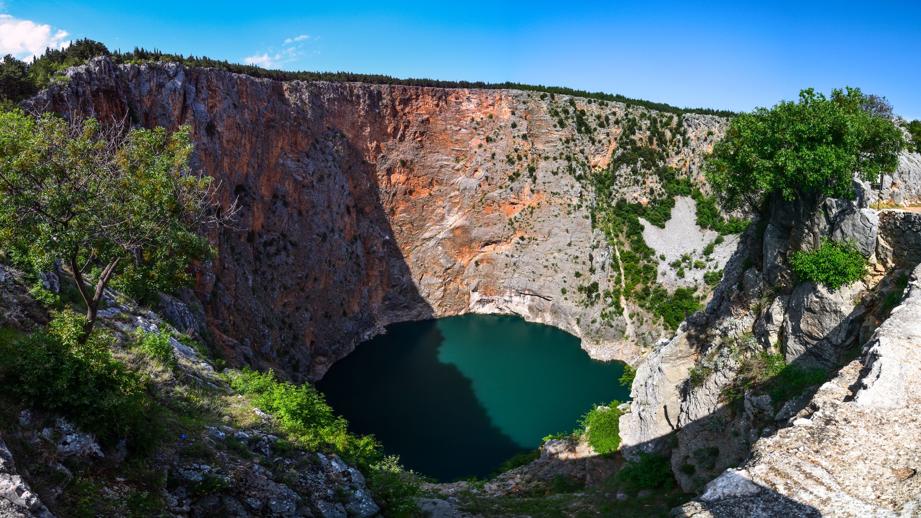
Sinkholes, known scientifically as dolines or tiankengs (meaning "heavenly pits" in Chinese), are depressions or holes in the ground caused by some form of collapse of the surface layer. They are most commonly associated with karst topography—a landscape formed from the dissolution of soluble rocks such as limestone, dolomite, and gypsum.
To understand how the world's largest sinkholes form, one must examine the interaction between rainwater, carbon dioxide, and soluble bedrock. Rainwater absorbs carbon dioxide from the atmosphere and soil, becoming a weak carbonic acid. As this mildly acidic water percolates downward through fractures and joints in the limestone, it slowly dissolves the calcium carbonate. Over thousands or millions of years, this chemical weathering carves out intricate networks of underground drainage systems, caves, and cavernous chambers.
When the roof of one of these subterranean cavities becomes too thin to support the weight of the overlying strata and soil, it collapses. This failure can happen catastrophically, creating a sudden steep-walled depression, or it can occur gradually through continuous downward shifting of surface materials. While many sinkholes are small, spanning only a few meters and posing localized hazards to infrastructure, others reach monumental scales, transforming entire landscapes and creating unique micro-ecosystems isolated from the surrounding world.
The Champion: Xiaozhai Tiankeng in Chongqing, China
Located in Fengjie County of Chongqing Municipality, China, the Xiaozhai Tiankeng is universally recognized by geologists as the deepest and largest sinkhole on Earth. The term "tiankeng" is specifically reserved by geomorphologists for karst collapse depressions that have a depth and width greater than 100 meters and feature active underground rivers at their base.
Xiaozhai Tiankeng is a double-nested structure, consisting of an upper bowl and a lower bowl. The upper bowl is about 320 meters deep, while the lower bowl plunges another 342 meters, bringing the total maximum depth to an astonishing 662 meters. Its volume is estimated at roughly 119 million cubic meters, making it a staggering geological chasm.
| Feature | Specification |
|---|---|
| Location | Fengjie County, Chongqing, China |
| Type | Karst Tiankeng (Double-nested collapse depression) |
| Maximum Depth | 662 meters (2,172 feet) |
| Length at Surface | 626 meters (2,054 feet) |
| Width at Surface | 537 meters (1,762 feet) |
| Estimated Volume | 119 million cubic meters |
| Key Hydrological Feature | Difeng subterranean river running through the bottom |
Hydrology and the Subterranean River System
The massive scale of Xiaozhai Tiankeng is maintained and shaped by an active underground river system. The Difeng subterranean river, which flows approximately 900 meters beneath the surface at its deepest point, runs through the bottom of the sinkhole. This river originates from another nearby gorge and eventually empties into the Yangtze River.
During heavy rainfall events, the volume of water flowing through the subterranean system increases dramatically. The bottom of the sinkhole can experience temporary flooding when the underground channels reach their maximum carrying capacity, showcasing the dynamic and ongoing nature of karst erosion.
Biodiversity and Micro-ecosystems
Because of its extreme depth and steep, sheer walls, Xiaozhai Tiankeng functions as a unique biological island. Sunlight penetrates to different degrees along the vertical profile, creating distinct microclimates ranging from temperate zones near the rim to humid, shaded environments at the bottom.
Botanical surveys conducted within the sinkhole have identified over 1,200 species of plants, including rare tree species, medicinal herbs, and delicate ferns. The isolation of the lower depths has also provided a habitat for specialized fauna, including endemic insect species and the rare clouded leopard (Neofelis nebulosa), which has occasionally been documented in the surrounding rugged karst terrain.
Other Contenders for Scale: The Deepest Blue Holes and Giant Potholes
While Xiaozhai Tiankeng holds the crown for volume and depth in a terrestrial land-based tiankeng, other geological formations vie for records in different categories, such as marine sinkholes (blue holes) and structural depth.
Sansha Yongle Blue Hole (Dragon Hole)
Located in the South China Sea, the Sansha Yongle Blue Hole, locally known as the Dragon Hole, is recognized as the deepest known marine sinkhole in the world. Soundings and underwater robotic measurements place its depth at approximately 300 meters (984 feet) below sea level.
Unlike terrestrial sinkholes formed in dry karst landscapes, blue holes formed during past ice ages when sea levels were significantly lower. Rainwater dissolved the limestone bedrock far below the modern surface, and as global sea levels rose, these deep vertical caves flooded with ocean water. The Dragon Hole is largely anoxic (lacking oxygen) below a depth of about 100 meters, meaning marine life cannot survive in its deeper abyssal layers, though the upper rim supports diverse coral reef ecosystems.
Dean's Blue Hole
Situated in a bay west of Clarence Town on Long Island, Bahamas, Dean's Blue Hole plunges 202 meters (663 feet) into the ocean floor. It is celebrated globally by free-diving enthusiasts due to its accessibility right off the shore and its exceptionally clear water, which allows for visibility exceeding 30 meters. It represents another vital facet of karst geomorphology operating in coastal marine environments.
Sima Humboldt and Sima Martel
Found atop the remote Tepuis (table mountains) of the Bolívar state in Venezuela, Sima Humboldt is one of the world's largest sinkholes formed in quartzite rather than limestone. Quartzite is significantly more resistant to chemical weathering than limestone, making the formation of a 314-meter-deep, 352-meter-wide sinkhole like Sima Humboldt exceptionally rare. The sheer vertical walls of Sima Humboldt support a self-contained forest at its base that is entirely isolated from the surrounding tabletop plateau.
Environmental Significance and Conservation Challenges
Giant sinkholes like Xiaozhai Tiankeng and marine blue holes are not merely geological curiosities; they are critical scientific archives and delicate natural environments that require careful management.
Climate and Paleoclimatic Records
The sedimentary deposits, stalagmites, and stalactites preserved within the cave systems connected to massive sinkholes offer high-resolution records of past climate change. By analyzing oxygen and carbon isotopes in mineral deposits, geoscientists can reconstruct historical rainfall patterns, monsoon intensities, and temperature fluctuations spanning hundreds of thousands of years. This data is invaluable for validating climate models and understanding long-term environmental cycles.
Human Impact and Ecotourism
In recent decades, regions hosting world-class sinkholes have experienced significant increases in tourism infrastructure. In Chongqing, walkways, viewing platforms, and access roads have been constructed to accommodate visitors wishing to witness the scale of Xiaozhai Tiankeng.
However, increased human activity brings environmental challenges:
- Water Contamination: Surface runoff from tourist facilities and agricultural land can introduce pollutants into the vulnerable subterranean river systems, disrupting fragile aquatic ecosystems.
- Habitat Fragmentation: Construction of roads and viewing areas alters the micro-habitats of endemic plant and animal species living along the sinkhole walls.
- Erosion Control: Foot traffic on steep karst slopes can accelerate soil erosion, destabilizing sections of the terrain.
To mitigate these impacts, local conservation authorities enforce strict zoning laws, limit visitor numbers in sensitive zones, and implement wastewater treatment protocols to preserve the ecological integrity of these natural monuments.
Safety and Exploration Guidelines for Karst Terrain
Exploring or visiting regions characterized by massive sinkholes requires adherence to strict safety standards, as karst landscapes are inherently dynamic and unpredictable.
- Geotechnical Monitoring: Before opening any area near a major sinkhole to the public, comprehensive geological surveys using ground-penetrating radar and seismic monitoring must be conducted to detect hidden fractures or unstable overhangs.
- Strict Perimeter Control: Visitors must remain on designated trails and viewing platforms. The rims of tiankengs are often undercut by weathering, making unpaved edges prone to sudden collapse.
- Professional Caving Protocols: Entering the subterranean cave networks beneath sinkholes requires specialized training, technical vertical caving equipment (SRT), and experienced guides. Flash floods pose a lethal hazard in these environments, as heavy rainfall miles away can rapidly inundate subterranean passages.
- Water Safety: Natural water sources within karst systems should never be consumed untreated due to potential microbial contamination from agricultural runoff in the upper catchment areas.
Summary and Outlook for Karst Research
The world's largest sinkholes, anchored by the magnificent Xiaozhai Tiankeng in China and complemented by marine marvels like the Dragon Hole, represent the pinnacle of karst geomorphology. These colossal depressions provide a window into the powerful, slow-moving chemical forces that shape our planet's crust. As scientific exploration methods advance with sonar mapping, autonomous underwater vehicles (AUVs), and satellite remote sensing, researchers continue to uncover deeper secrets hidden within Earth's most dramatic subterranean abysses. Continued interdisciplinary study between geologists, hydrologists, and conservationists remains essential to protecting these natural wonders while unlocking the historical data they contain.
Image Gallery
Select an image to open it in a new tab.

Vivian Cho
Executive IT and Emerging Technologies Reporter
