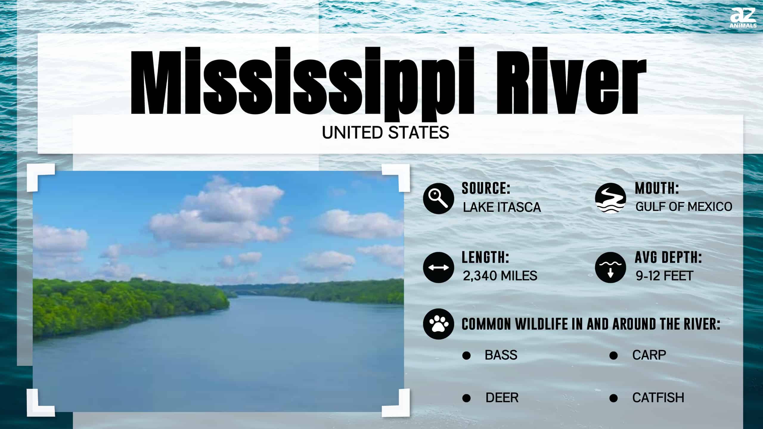
The Mississippi River is a massive fluvial system located in the central United States, serving as the primary drainage artery for a vast portion of the North American continent. Stretching from its headwaters at Lake Itasca in Minnesota to its discharge into the Gulf of Mexico, the river acts as a vital commercial, ecological, and hydrological backbone for the nation’s midsection.
The Geographic Scope of the Mississippi River
The Mississippi River defines the heart of the central United States. It flows through or along the borders of ten states: Minnesota, Wisconsin, Iowa, Illinois, Missouri, Kentucky, Tennessee, Arkansas, Mississippi, and Louisiana. As the fourth-longest river in the world when combined with its primary tributary, the Missouri River, it forms an expansive watershed known as the Mississippi River Basin.
This basin covers roughly 40% of the contiguous United States. To understand the scale, consider that the river collects water from as far west as the Rocky Mountains and as far east as the Appalachian Mountains. Because the river is situated in the central United States, it acts as a dividing line for the country, historically influencing settlement patterns, state boundaries, and the distribution of regional geography.
Hydrology and Navigation
Navigation on the Mississippi River is managed largely through a complex system of locks and dams, particularly in the Upper Mississippi region. The United States Army Corps of Engineers (USACE) maintains a nine-foot navigation channel that allows commercial barges to transport bulk commodities such as corn, soybeans, coal, and petroleum products.
The river is essentially divided into two distinct sections for management and navigational purposes:
- The Upper Mississippi River: Extends from Lake Itasca to the confluence with the Ohio River at Cairo, Illinois. This stretch is characterized by its lock-and-dam system designed to manage water levels and facilitate heavy freight transit.
- The Lower Mississippi River: Extends from the Ohio River confluence to the Gulf of Mexico. This segment is deeper and generally free-flowing, characterized by massive levees and flood control structures designed to contain the river’s immense discharge during seasonal high-water periods.
Economic Importance and Commercial Infrastructure
The Mississippi River is arguably the most critical inland waterway in North America. By providing an efficient, low-cost method for transporting raw materials from the interior of the continent to global markets, the river supports the economic viability of the American agricultural sector.
In 2026, the logistics chain remains heavily dependent on this waterway. Barges remain the most fuel-efficient method for bulk transport, moving significantly more freight per gallon of fuel than rail or truck. The infrastructure supporting this includes river terminals, grain elevators, and specialized ports such as the Port of South Louisiana and the Port of New Orleans. These facilities are the termination points for cargo moving downriver, where goods are transferred to ocean-going vessels for international export.
Environmental Dynamics and Flood Management
Living in the central United States near the Mississippi River involves a constant interaction with the river’s dynamic environment. Seasonal flooding, driven by spring snowmelt in the north and heavy rainfall in the Ohio and Missouri river valleys, poses a perennial challenge to infrastructure.
The Mississippi River Commission, established in 1879, oversees the Mississippi River and Tributaries (MR&T) project. This is one of the most significant engineering projects in human history, consisting of a massive system of levees, floodways, and bypasses. These interventions were designed to keep the river in its current channel and protect cities like St. Louis, Memphis, and New Orleans from catastrophic flooding. However, environmental scientists often debate the long-term impacts of these modifications, noting that they can accelerate water velocity and reduce the river’s natural ability to deposit sediment in surrounding wetlands.
Recreational and Ecological Value
Beyond its industrial utility, the Mississippi River is a vital ecological corridor. It serves as a major migratory flyway for birds and provides critical habitat for hundreds of fish and mammal species. The Upper Mississippi River National Wildlife and Fish Refuge is a prime example of the preserved space dedicated to maintaining biodiversity along the river’s path.
Recreation plays a significant role in the local economies of the towns bordering the river. From recreational boating and fishing to ecotourism, the river provides diverse opportunities for public engagement. Many communities in the central United States have invested in "riverfront revitalization" projects over the last decade, transitioning old industrial docks into parks and walking paths that connect urban centers back to the water.
Comparative Overview of River Sections
| Feature | Upper Mississippi | Lower Mississippi |
|---|---|---|
| Primary Controls | Locks and Dams | Levees and Floodways |
| Channel Depth | Maintained at 9 feet | Naturally deep; 45+ feet |
| Topography | Rolling hills and bluffs | Flat alluvial plain |
| Flow Characteristic | Regulated | Relatively free-flowing |
| Primary Industry | Agriculture/Grain transport | Energy/Chemical/Export |
Frequently Asked Questions
1. Where exactly does the Mississippi River begin and end? The river begins at Lake Itasca in Clearwater County, Minnesota. It terminates at the Gulf of Mexico, south of New Orleans, Louisiana, after passing through its vast deltaic region.
2. How do locks and dams affect the river? Locks and dams on the Upper Mississippi are used to create "pools," or stepped water levels, which ensure that the river remains deep enough for commercial vessels to pass, especially during periods of low flow. They effectively turn the river into a series of navigable lakes.
3. What is the role of the Army Corps of Engineers on the river? The USACE is responsible for the maintenance of the navigation channel, the construction and upkeep of flood control levees, and the regulation of water flow to minimize flood damage to surrounding residential and agricultural lands.
4. Why is the Mississippi River important to the American economy? It serves as an economic highway. A large percentage of U.S. agricultural exports travel down the Mississippi system by barge to the Gulf Coast ports, where they are loaded onto ships for global distribution. This keeps shipping costs significantly lower than overland transit.
5. Are there risks to living near the Mississippi River? The primary risk is flooding. While levee systems provide significant protection, extreme weather events can stress these structures, requiring evacuation plans and constant monitoring by local, state, and federal authorities. Residents should always verify their specific location's flood zone status through FEMA maps.
Managing Risks and Next Actions
For those residing in or operating businesses near the Mississippi River, risk management is essential. Property owners should verify their flood zone status via official FEMA flood insurance rate maps (FIRMs). Businesses involved in logistics or riverfront development must coordinate with the USACE to ensure compliance with federal permitting requirements for any construction or modification near the riverbank.
If you are planning an activity on the river, whether for commercial or recreational purposes, always monitor the National Weather Service river gauge data. These gauges provide real-time updates on river stages and projected flood levels, which are critical for safe operations in the central United States. Engaging with local river conservation groups can also provide valuable insight into the current environmental status and local navigation hazards in specific segments of the waterway.
Image Gallery
Select an image to open it in a new tab.
Vivian Cho
Executive IT and Emerging Technologies Reporter
