How Real Time GPS Tracking Systems Work: A Comprehensive Technical Overview

Real-time GPS tracking systems function by combining satellite-based positioning, cellular or satellite data transmission, and a central processing platform. A tracking device calculates its exact geographic coordinates using the Global Positioning System (GPS) constellation and continuously relays this location data via wireless networks to a cloud-based server, where it is visualized on a map for the end user in near-real time.
The Triad of Real-Time Tracking Architecture
To understand how real-time GPS tracking works, one must look at it as a three-part ecosystem. A breakdown in any of these three components results in a failure to deliver position updates to the user.
1. The Space Segment: GPS Constellation
The process begins with the Global Positioning System, a constellation of satellites operated by the United States Space Force. At any given moment, there are at least 24 satellites in medium Earth orbit. These satellites continuously broadcast time-stamped radio signals toward Earth. A GPS tracking device is, fundamentally, a passive receiver; it does not transmit signals to the satellites. Instead, it listens for these signals. By measuring the time delay between the signal being sent and the signal being received, the tracker calculates its distance from at least four satellites to triangulate its position (latitude, longitude, and altitude).
2. The Device Segment: Data Acquisition
The tracking hardware (often referred to as an asset tracker, OBD-II dongle, or personal tracker) contains a GPS antenna and a specialized processor. Once the device calculates its position, it stores this data internally. In a real-time system, the device is configured with a set of rules—such as reporting intervals (e.g., every 30 seconds) or event-based triggers (e.g., ignition on, motion detected, or geofence exit). Once these conditions are met, the device prepares a data packet containing its coordinates, timestamp, speed, heading, and often auxiliary data like battery levels or diagnostic trouble codes (DTCs) from a vehicle's onboard computer.
3. The Transmission Segment: Connectivity
This is where "real-time" capability is realized. Once the device has the data, it must send it to the internet. Most modern trackers use cellular networks (LTE-M, NB-IoT, or 4G/5G) to transmit these packets. Some specialized units designed for remote operations where cellular coverage is absent use satellite networks, such as Iridium or Globalstar, though these are typically more expensive. The device acts like a specialized cellular phone, establishing a connection with a cellular tower to relay the data to a backend server.
Data Processing and Visualization
Once the data reaches the service provider’s server, the backend infrastructure takes over. This layer handles the ingestion of thousands of data points per second. The server parses the raw data packets, matches them against digital maps (like OpenStreetMap or Google Maps API), and stores the history in a database.
The end-user portal—whether a mobile app or a desktop dashboard—queries this database to display the moving icon on the map. Because this sequence (Receive GPS -> Transmit Cellular -> Process Server -> Display Client) happens in a matter of seconds, the system provides a "real-time" view of the asset's location.
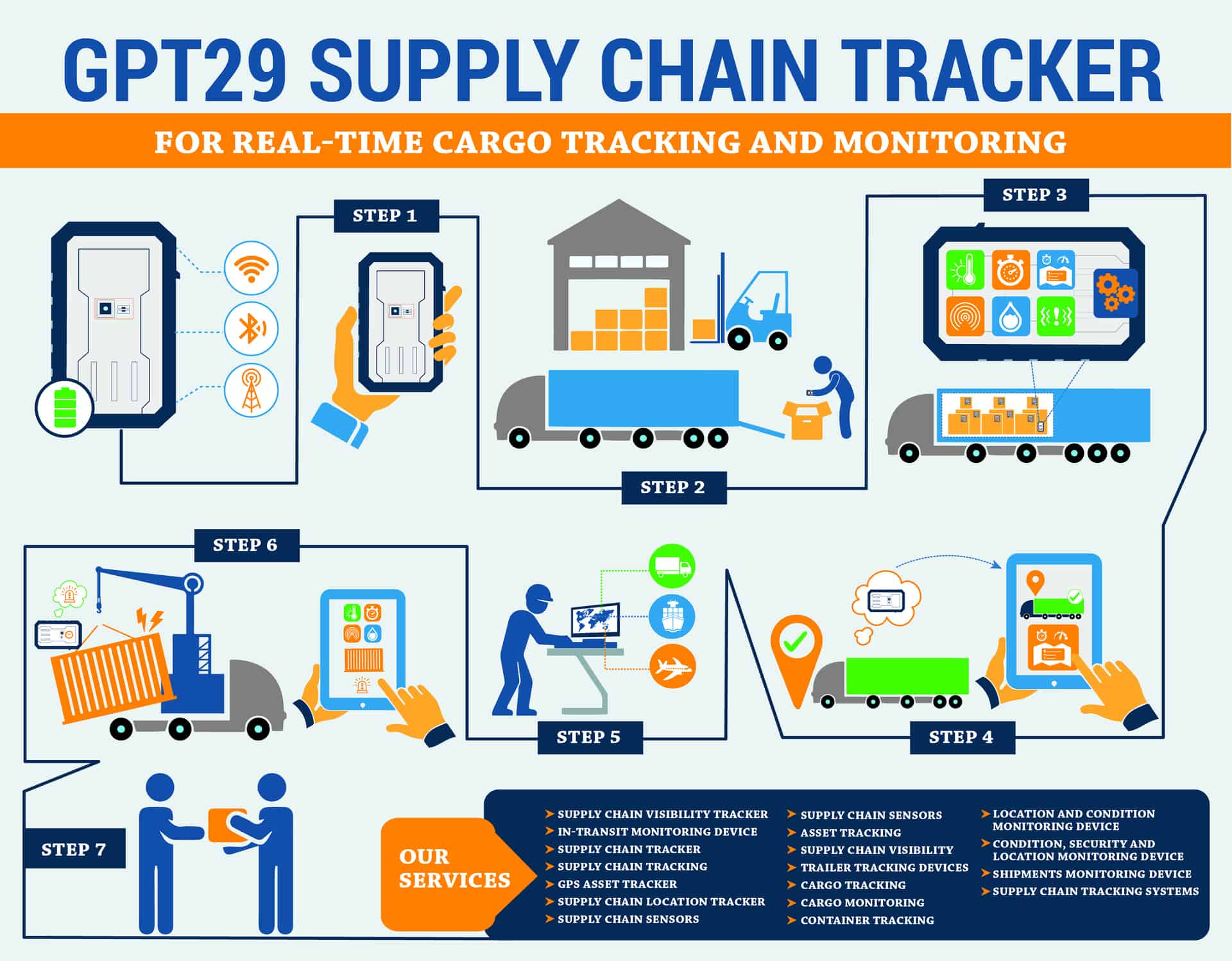
Key Components of Tracking Hardware
| Component | Function |
|---|---|
| GNSS Receiver | Captures satellite signals to determine precise spatial coordinates. |
| Cellular Modem | Transmits the collected coordinates to the cloud server via mobile networks. |
| Microcontroller (MCU) | Acts as the "brain," managing power, sensor input, and transmission timing. |
| Internal Battery | Provides a power buffer or autonomous operation if the main power source is cut. |
| Sensors | Accelerometers or gyroscopes that detect motion to trigger reporting or save power. |
Latency and Real-World Limitations
While marketed as "real-time," there is always inherent latency. A system reporting every 30 seconds is effectively "near-real-time." Factors contributing to delay include:
- Cellular Dead Zones: If the tracker enters a tunnel, a parking garage, or a rural area without cellular coverage, it cannot transmit. The tracker will buffer the data in its internal memory and "burst" upload it once it regains a connection.
- Satellite Acquisition Time: "Cold starts"—when a device is powered on after being off for a long period—require more time to lock onto satellite signals compared to a "warm start."
- Network Congestion: Heavy traffic on mobile networks can occasionally delay the delivery of the data packet, though this is rare with modern IoT-specific network protocols.
Operational Modes and Power Management
Engineers design trackers to balance update frequency with battery life. A device that reports its location every second will deplete a battery rapidly. Consequently, most systems utilize Adaptive Tracking:
- Sleep Mode: The device enters a low-power state when it detects no motion via its internal accelerometer.
- Wake-on-Move: Upon detecting vibration or movement, the device activates the GPS and modem.
- Heartbeat Reporting: If the asset is stationary for an extended period, the device may send a "heartbeat" signal once every few hours simply to confirm it is still online.
Security and Privacy Considerations
Real-time tracking involves the transmission of sensitive location data. Modern systems typically employ end-to-end encryption to prevent unauthorized interception of the data packets between the tracker and the server. Users should ensure that their chosen platform adheres to standard data privacy practices, as the location history of an individual or vehicle is considered sensitive information. Furthermore, users must be aware of local jurisdictional laws regarding the surveillance of assets or individuals, as legal restrictions often apply to how and where such devices may be deployed.
Troubleshooting Common Issues
Device Shows "Offline"
If a device stops reporting, the first step is to verify the cellular coverage in the area. If the device was recently moved, it may be in a "blind spot." If it remains offline for an extended period, verify that the subscription plan associated with the SIM card is active.
Inaccurate Location (Drift)
GPS drift occurs when signals bounce off tall buildings, canyons, or dense tree cover (known as the "urban canyon" effect). The tracker may report a position that is several meters away from the actual location. If the device reports a position that is kilometers away, it may have failed to get a satellite fix and is reporting the last known location or the location of the nearest cellular tower (Cell ID positioning).
Battery Drain
If a hardwired tracker is draining a vehicle's battery, check for "parasitic draw." This occurs if the device is not entering its low-power sleep mode correctly because it incorrectly senses the vehicle is still "on."
Frequently Asked Questions
Does a GPS tracker require a subscription? Yes, most real-time systems require a subscription. This fee covers the cellular data connectivity and the costs of hosting the cloud server, processing the data, and maintaining the software interface you use to view the location.
Can GPS trackers work without cell service? While they cannot transmit in real-time without a connection, most professional trackers include internal memory (data logging). They will save the tracking history and upload it as soon as the device returns to an area with cellular coverage.
What is the difference between active and passive tracking? Active tracking (real-time) sends data as it is collected using cellular or satellite networks. Passive tracking devices store location data on a memory card or internal flash memory, which must be physically retrieved or synced later to view the history.
Are there legal restrictions on using GPS trackers? Yes. While using a tracker on your own property or fleet vehicles is generally permitted, using a device to track an individual without their consent or legal authority can violate privacy laws. Always verify the laws in your specific jurisdiction.
How accurate are real-time GPS systems? Standard commercial GPS trackers typically provide an accuracy of within 5 to 10 meters under optimal conditions. Factors like heavy cloud cover, signal reflection, or poor line-of-sight to the sky can reduce this accuracy.
Next Actions
To implement a real-time tracking solution, first identify your primary requirement: battery life, frequency of reporting, or ruggedization for environmental exposure. If you are monitoring a vehicle, opt for an OBD-II port-powered tracker for ease of installation. If you are tracking non-powered assets like shipping containers, select a device with a long-life internal battery and an IP67-rated waterproof housing. Always perform an initial "live test" by moving the device through your intended area of operation before final deployment to ensure cellular signal reliability.
Image Gallery
Select an image to open it in a new tab.




Simon Caldwell
Enterprise Technology and Systems Editor
