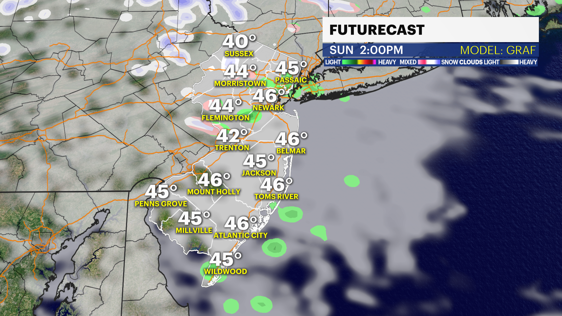
New Jersey features a diverse climate primarily categorized as humid subtropical in the south and central regions, while the northwestern highlands exhibit a humid continental climate. The state experiences four distinct seasons characterized by cold winters, warm to hot summers, and moderate precipitation distributed fairly evenly throughout the year, influenced significantly by its proximity to the Atlantic Ocean and the Appalachian Mountains.
The Geographic Foundation of New Jersey’s Climate
To understand the weather patterns in New Jersey as of 2026, one must first examine the state’s unique geography. Despite being one of the smallest states in the U.S., New Jersey possesses a topographical variety that creates distinct microclimates. The state is situated at a meteorological crossroads where cold air masses from Canada often collide with warm, moist air from the Gulf of Mexico and the Atlantic Ocean.
The Influence of the Atlantic Ocean
The Atlantic Ocean serves as the most significant stabilizing force for New Jersey’s climate. Coastal areas, stretching from Sandy Hook down to Cape May, benefit from a maritime influence. In the summer, the "sea breeze" effect can keep beach temperatures 10 to 15 degrees Fahrenheit cooler than inland locations like Camden or New Brunswick. Conversely, in the winter, the ocean remains relatively warmer than the frozen landmass, often preventing coastal temperatures from dropping as low as those in the interior. This maritime buffer frequently results in "rain-snow lines" during winter storms, where the coast receives rain while the inland regions are buried in snow.
The Appalachian Highlands and the Fall Line
The northwestern portion of the state, dominated by the Appalachian Mountains, presents a sharp contrast to the coastal plains. Higher elevations in Sussex and Warren counties lead to shorter growing seasons and significantly higher annual snowfall. The "Fall Line," a geological boundary where the hard rock of the Piedmont meets the softer Atlantic Coastal Plain, roughly follows the path of the New Jersey Turnpike. This line often serves as a dividing marker for weather behavior; north of the line, storms are more likely to stay frozen, while south of it, the influence of the warmer coastal plain often prevails.
Seasonal Weather Patterns in New Jersey
New Jersey is a "four-season" state, and each period brings specific meteorological expectations and challenges for residents and travelers.
Winter (December through February)
Winters in New Jersey are characterized by variability. Temperatures typically range from highs in the mid-30s to low 40s (°F) and lows in the 20s. However, "Arctic outbreaks" can occasionally push temperatures below zero, especially in the Northwest.
The primary driver of significant winter weather is the Nor’easter. These are low-pressure systems that track up the Atlantic coast. Because of the counter-clockwise rotation of these storms, they draw in moisture from the ocean and cold air from the north. Depending on the exact track of the storm, New Jersey may experience anything from a cold, driving rain to a blizzard. By 2026, data suggests a trend toward "wetter" winters, where total precipitation remains high, but the ratio of rain to snow fluctuates more wildly than in previous decades.
Spring (March through May)
Spring is arguably the most volatile season in the Garden State. March often acts as a battleground between retreating winter air and advancing tropical warmth. It is not uncommon for New Jersey to experience a heavy snowstorm in early March, followed by 70-degree days by the end of the month.
As April and May progress, the state sees a surge in "convective activity." As the land heats up faster than the ocean, the temperature contrast triggers thunderstorms. Spring is also the primary season for the "backdoor cold front," a phenomenon where high pressure over the Canadian Maritimes pushes cool, damp ocean air southwestward into New Jersey, causing temperatures to drop 20 degrees in a matter of hours.
Summer (June through August)
New Jersey summers are typically warm and humid. The dominant weather feature during this time is the Bermuda High, a large area of high pressure over the Atlantic. When this system pumps southwesterly winds into the state, New Jersey experiences "Hazy, Hot, and Humid" conditions.
Temperatures in July and August frequently climb into the 80s and 90s. Heatwaves, defined as three or more consecutive days of 90°F or higher, are common in the urban corridors of North and South Jersey. The "Urban Heat Island" effect is particularly pronounced in cities like Newark, Jersey City, and Trenton, where asphalt and concrete retain heat overnight, preventing the mercury from dropping and providing little relief for residents.
Autumn (September through November)
Autumn is frequently cited by residents as the most pleasant season. As the Bermuda High weakens, the humidity drops, and the state experiences "Cananda High" systems that bring crisp, clear air and deep blue skies.
September still carries the risk of tropical weather, as it is the peak of the Atlantic Hurricane Season. However, by October, the focus shifts to the spectacular fall foliage, which peaks in the north in mid-October and reaches the south by early November. Frost typically arrives in the Highlands by early October, while the coastal regions may remain frost-free until late November.

Regional Climate Zones of New Jersey
The Office of the New Jersey State Climatologist divides the state into five distinct climate zones based on geology, distance from the ocean, and prevailing winds.
| Climate Zone | Geographic Area | Primary Characteristics |
|---|---|---|
| Northern | Sussex, Warren, Morris | Colder temperatures, highest snowfall, rugged terrain. |
| Central | Hunterdon, Somerset, Mercer, Middlesex | A transition zone; high moisture, influenced by urban heat. |
| Pine Barrens | Burlington, Ocean, Atlantic (Inland) | Porous sandy soil leads to rapid temperature drops at night. |
| Southwest | Salem, Gloucester, Camden | Warmer temperatures, longer growing season, influenced by Delaware Bay. |
| Coastal | Monmouth, Ocean, Atlantic, Cape May | Maritime influence; cooler summers and milder winters. |
The Unique Microclimate of the Pine Barrens
The Pine Barrens in Southern New Jersey deserve special mention. Because the soil is primarily sand, it does not retain heat well. On clear, calm nights, the Pine Barrens act like a desert, with heat radiating rapidly into the atmosphere. It is common for weather stations in the Pine Barrens to report temperatures 10 to 15 degrees colder than surrounding areas, sometimes recording frost even in late spring or early autumn when other regions are mild.
Extreme Weather and Natural Hazards
New Jersey is susceptible to several types of extreme weather that require preparation and infrastructure management.
Tropical Cyclones and Hurricanes
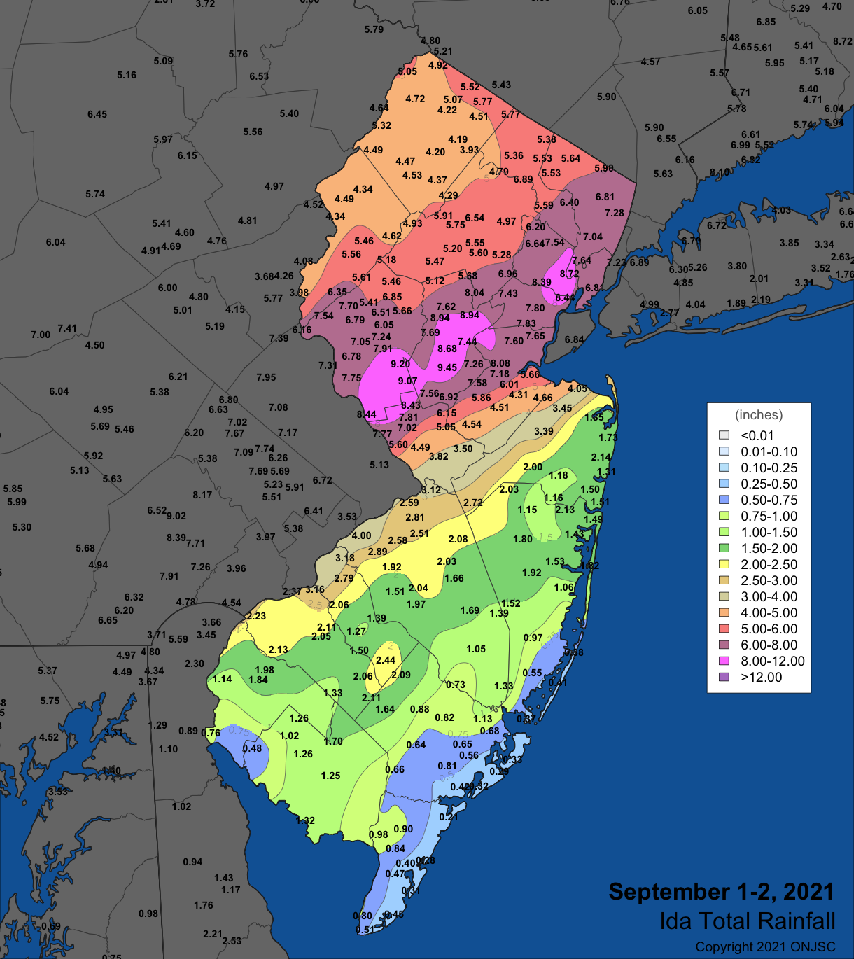
While direct landfalls of major hurricanes are statistically rare in New Jersey compared to the Carolinas or Florida, the state is frequently impacted by tropical storms and "post-tropical" cyclones. These events bring torrential rains and inland flooding, which is often more damaging than the wind itself. The remnants of storms moving up from the Gulf of Mexico can also trigger tornadoes, though New Jersey tornadoes are typically weak (EF0 or EF1) and short-lived.
Nor’easters and Coastal Flooding
Nor’easters are the most frequent cause of coastal erosion and "nuisance flooding" in New Jersey. Because these storms can stall off the coast for multiple high-tide cycles, they push massive amounts of water into the back bays and coastal inlets. By 2026, the frequency of "sunny day flooding"—flooding caused by high tides rather than rain—has increased in communities like Atlantic City and Sea Bright due to rising sea levels.
Droughts and Heatwaves
Despite being a water-rich state, New Jersey experiences periodic droughts. These occur when the expected atmospheric moisture from the Gulf is blocked by persistent high-pressure ridges. Droughts in New Jersey can lead to water use restrictions and increase the risk of wildfires, particularly in the highly flammable pitch pine forests of the Pine Barrens.
Climate Trends and Projections for 2026
As of 2026, long-term data from the National Oceanic and Atmospheric Administration (NOAA) indicates that New Jersey’s climate is shifting in several measurable ways.
- Rising Average Temperatures: Over the last century, New Jersey has warmed faster than many other states. This is most evident in winter minimum temperatures, which are higher than historical averages, leading to fewer days of lake ice and changes in migratory patterns for local wildlife.
- Increased Precipitation Intensity: While the total annual rainfall has increased slightly, the intensity of individual rain events has grown. New Jersey now sees more "heavy downpours" that can overwhelm older storm sewer systems in urban areas.
- Sea Level Rise: The New Jersey coastline is particularly vulnerable to sea-level rise due to a combination of melting glacial ice and land subsidence (the land literally sinking). This makes coastal storms more impactful than they were 50 years ago.
Practical Guidance for Navigating New Jersey Weather
For those living in or visiting New Jersey, managing the weather requires a multi-faceted approach:
- Layering is Essential: Especially in spring and autumn, temperature swings of 30 degrees in a single day are common.
- Flood Awareness: If you are moving to New Jersey, check the FEMA Flood Map Service Center to understand the risks associated with specific properties, even those not directly on the coast.
- Vehicle Preparation: Ensure your vehicle has high-quality all-season or winter tires if you live in the Northern zone. Road salt is used extensively in NJ, so regular undercarriage washes in the winter are necessary to prevent corrosion.
- Emergency Alerts: Residents should sign up for "NJ Alerts" or local municipal notification systems, as flash flooding in the state’s many small river basins (like the Rahway or Passaic rivers) can happen with very little warning.
Frequently Asked Questions
How much snow does New Jersey get on average? Snowfall varies wildly by region. The northwestern highlands average between 40 and 50 inches per year. The central corridor typically sees 25 to 30 inches, while the southern coastal tip near Cape May may average less than 15 inches. However, these are averages; some years see almost no snow, while others feature record-breaking "Snowmageddons."
Is New Jersey humid? Yes, New Jersey is considered a humid state. During the summer months, the "dew point"—a measure of atmospheric moisture—frequently rises above 70°F, which most people find "oppressive." This humidity is driven by the state's proximity to the warm waters of the Atlantic and the moisture-laden air masses traveling up from the Gulf of Mexico.
When is the best time of year to visit New Jersey for weather? Most travelers prefer the window from mid-September to late October. During this time, the heat and humidity of summer have broken, the risk of severe thunderstorms is low, and the fall foliage provides a scenic backdrop. May is also popular, though it can be rainier than the autumn months.
Does New Jersey get tornadoes? Yes, but they are relatively rare and usually less intense than those in the "Tornado Alley" of the Midwest. New Jersey averages about two to five tornadoes per year. Most occur during severe summer thunderstorms or as a result of tropical storm remnants.
Why is it always so much colder in North Jersey than South Jersey? The temperature difference is due to both latitude and elevation. North Jersey is further from the equator and contains the state’s highest peaks (reaching up to 1,803 feet at High Point). Additionally, South Jersey is more influenced by the warmer waters of the Delaware Bay and the Atlantic Coastal Plain, which retain heat more effectively than the rocky soil of the north.
Final Recommendation
To stay safe and comfortable in New Jersey’s dynamic climate, always prioritize local forecasts over national generalizations. Because of the state's complex geography, a "rainy day" in Cape May could be a "blizzard" in High Point. Utilize resources from the Rutgers NJ Weather Network for real-time, hyper-local data to make the most of what the Garden State has to offer.
Image Gallery
Select an image to open it in a new tab.
Mateo Castillo
Decentralized Finance and E-Payments Strategist
