
Finding a safe neighborhood in Washington DC requires balancing objective crime data with subjective lifestyle preferences, as the city’s urban landscape varies significantly block by block. To make an informed decision, prospective residents should analyze official Metropolitan Police Department (MPD) data, assess local community engagement levels, and evaluate the environmental factors—such as lighting and foot traffic—that contribute to perceived and actual safety in specific quadrants.
Understanding the Landscape of Washington DC
Washington DC is organized into eight wards, each with distinct neighborhoods, housing types, and safety profiles. Because the city is highly dense and features a mix of residential, commercial, and federal zones, safety can fluctuate drastically within a short walking distance. Rather than viewing the city through the lens of broad neighborhood reputations, it is more effective to treat DC as a collection of micro-environments.
A high-traffic, well-lit commercial corridor may feel very different from a quiet side street just two blocks away. When beginning your search, recognize that the "safest" area is often defined by a combination of public activity, effective infrastructure (such as street lighting and well-maintained sidewalks), and community cohesion.
Leveraging Official Data Sources
The primary, objective way to assess the safety of a neighborhood is to consult data provided by the Metropolitan Police Department (MPD). The MPD maintains an Open Data portal that provides real-time access to crime statistics, including incident reports and calls for service.
When analyzing this data, do not look solely at raw numbers. High-density areas, such as those near major transit hubs or nightlife districts, will naturally show higher incident reports due to the volume of people present. Instead, focus on:
- Crime Trends: Compare year-over-year data to see if a neighborhood is experiencing an uptick or a stabilization in specific types of incidents.
- Crime Type: Distinguish between violent crime and property crime. Some neighborhoods may have higher rates of package theft but very low rates of violent crime, which may influence your comfort level differently.
- Service Calls: Note that non-emergency calls can indicate how active the local community is in reporting issues, which is often a sign of a proactive, vigilant neighborhood.
Evaluating Environmental and Infrastructure Cues
While crime data provides a historical baseline, your physical walkthrough of a neighborhood provides the immediate context of "livability." A safe neighborhood is often self-policed by its residents through active street usage—often referred to as "eyes on the street."
When visiting potential neighborhoods in 2026, observe these specific environmental indicators:
- Lighting: Are the streetlights functional? Dark corridors naturally discourage pedestrian activity, which can lead to a sense of isolation even if the area is statistically low-crime.
- Maintenance: Well-kept properties, clean sidewalks, and functioning public amenities (like parks and benches) are strong indicators of community investment. Neglect, such as abandoned cars or high levels of litter, can sometimes correlate with lower levels of community oversight.
- Transit Proximity: In DC, proximity to a Metro station often means high foot traffic. While this adds convenience, it also brings a transient population. Evaluate if the path from the Metro station to your potential home feels comfortable during evening hours.
Comparing Neighborhood Characteristics
Different parts of the city offer different types of safety experiences. The following table outlines how different types of DC zones generally perform regarding public safety perceptions and realities.
| Neighborhood Type | Characteristics | Safety Profile |
|---|---|---|
| Federal/Institutional | High presence of government buildings, offices, and restricted zones. | Very high visibility, frequent patrols, limited street life after business hours. |
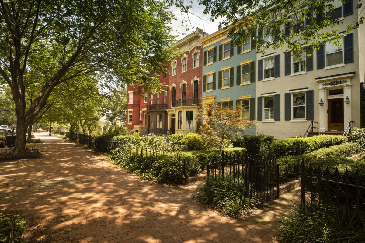
| Established Residential | Historic rowhouses, tree-lined streets, limited commercial encroachment. | Strong community cohesion, lower volume of transient pedestrian traffic. |
| Mixed-Use Commercial | High density, retail, nightlife, and dense apartment living. | High foot traffic, active surveillance by business owners, higher volume of petty/property crime. |
| Developing Corridors | Areas undergoing significant new residential construction and rapid transition. | Variable; often involves a mix of long-term residents and new arrivals, shifting safety profiles. |
Practical Steps for Neighborhood Verification
Before signing a lease or committing to a purchase, move beyond digital research to conduct "ground-truthing."
- Visit at Different Times: Visit the area during the day on a weekday, on a Friday or Saturday night, and during the morning commute. The atmosphere of a neighborhood can change dramatically when businesses close or when the work-from-home population is active.
- Talk to Current Residents: Stop by a local coffee shop or park and ask long-term residents about their experience. They will provide insights that statistics cannot capture, such as how the neighborhood handles emergency situations or how the local neighborhood watch group functions.
- Utilize Civic Associations: Almost every neighborhood in Washington DC has an active Civic Association or an Advisory Neighborhood Commission (ANC). Reviewing the minutes of recent ANC meetings will reveal the specific concerns of the local community—whether it is speeding traffic, street lighting requests, or noise complaints.
Common Mistakes to Avoid
One of the most common mistakes is relying exclusively on third-party mobile applications that aggregate crime "scores." These platforms often use proprietary algorithms that can misrepresent specific blocks by applying city-wide data averages to them. Always prioritize primary sources like the DC government’s official crime map.
Another mistake is dismissing an entire ward based on outdated reputations. Washington DC is a rapidly evolving city. Neighborhoods that were considered high-risk a decade ago may have undergone significant economic and community investment. Always evaluate the current context rather than relying on legacy perceptions from friends or online forums.
Important Considerations: Jurisdictional Boundaries
It is important to remember that Washington DC is a unique jurisdiction. Much of the city is under the authority of the Metropolitan Police Department, but certain federal lands, parks, and national monuments are managed by the United States Park Police or the Secret Service. This can sometimes lead to confusion regarding who to contact in an emergency. Ensure you know the boundaries of your immediate area and store the non-emergency numbers for your local police district in your phone.
Frequently Asked Questions
How can I find the specific crime data for my block in DC? You can access the Metropolitan Police Department’s Crime Map. This tool allows you to filter incidents by date, type, and police district. It is the most accurate source for neighborhood-specific data.
Does living near a police station make a neighborhood safer? Not necessarily. While police stations house officers, a safe neighborhood is more often the result of active community involvement. Proximity to a station may increase noise or traffic, and often the blocks immediately surrounding a station are not different from surrounding areas.
What is the role of an ANC in DC? Advisory Neighborhood Commissions (ANCs) are groups of elected representatives who advise the District government on matters like zoning, public safety, and infrastructure. They are the most direct way to voice concerns about neighborhood safety improvements.
Are there safe "walkable" neighborhoods in DC? Yes. Many neighborhoods in Northwest and Capitol Hill are highly walkable. Prioritize areas with high concentrations of small businesses and mixed-use development, as these areas tend to maintain a high level of natural surveillance.
Should I use private security apps to judge safety? Private apps can be useful for community alerts but should not be your sole source for safety assessments. These apps often focus on individual reports, which can be anecdotal and biased, rather than comprehensive, verified crime data.
Final Recommendation
The most effective way to ensure you are moving to a safe area in Washington DC is to prioritize community cohesion over static data points. Once you have identified a few candidate neighborhoods via online maps and crime statistics, commit to spending time in those areas at various times of the week. Observe the interaction between neighbors, the state of the infrastructure, and your own comfort level walking from the nearest public transit stop. Safety is a dynamic quality; by choosing a neighborhood with an active civic association and engaged residents, you are investing in a community that actively manages its own security and well-being.

Image Gallery
Select an image to open it in a new tab.

Mateo Castillo
Decentralized Finance and E-Payments Strategist
