When Did Hurricane Katrina Hit Louisiana? Dates, Times, and Historical Impact

Hurricane Katrina officially made landfall in Louisiana on the morning of Monday, August 29, 2005. The storm first struck the coast near Buras-Triumph in Plaquemines Parish at approximately 6:10 AM CDT as a strong Category 3 hurricane. It made a second Louisiana landfall near the mouth of the Pearl River later that morning.
The timeline of Hurricane Katrina is not merely a single calendar date; it is a sequence of meteorological events, engineering failures, and socio-economic shifts that redefined the Gulf Coast. While the physical wind and rain arrived on August 29, the crisis intensified over the following 24 to 48 hours as the levee systems in New Orleans failed, leading to the inundation of 80% of the city. Understanding the exact timing of these events is crucial for grasping why the disaster unfolded with such severity.
The Meteorological Timeline: From Formation to Landfall
To understand when Katrina hit Louisiana, one must look at the week leading up to the disaster. The storm did not originate in the Gulf of Mexico; it traveled a long path that gave authorities several days of warning, though the final intensity and trajectory remained subjects of intense scrutiny until the final 48 hours.
Formation and Florida Landfall (August 23–25, 2005)
Hurricane Katrina began as Tropical Depression Twelve over the southeastern Bahamas on August 23, 2005. It strengthened into a tropical storm on August 24 and made its first landfall in the United States as a Category 1 hurricane near the border of Miami-Dade and Broward Counties in Florida on August 25. At this stage, while significant, the storm was not yet the monster it would become.
Intensification in the Gulf (August 26–28, 2005)
After crossing Florida, Katrina entered the warm waters of the Gulf of Mexico. This environment acted as high-octane fuel for the storm. On August 26, the storm began a period of rapid intensification. By August 28, Katrina had grown into a massive Category 5 hurricane with maximum sustained winds of 175 mph.
During this 48-hour window, the National Hurricane Center (NHC) issued increasingly dire warnings. New Orleans Mayor Ray Nagin issued the first-ever mandatory evacuation order for the city on the morning of Sunday, August 28, less than 24 hours before the eye of the storm reached the Louisiana coastline.
The Louisiana Landfalls (August 29, 2005)
The "hit" on Louisiana occurred in two distinct stages on the morning of Monday, August 29:
- First Louisiana Landfall: At 6:10 AM CDT, the eye of Hurricane Katrina moved ashore near Buras-Triumph, Louisiana. Although it had weakened from a Category 5 to a Category 3, its massive size meant that its wind field and storm surge were far more powerful than a typical Category 3 storm. The central pressure at landfall was 920 mbar, making it one of the most intense storms to ever strike the U.S. mainland.
- Second Louisiana Landfall: The storm continued northward, making a second landfall near the Louisiana-Mississippi border (specifically near the mouth of the Pearl River) at approximately 10:00 AM CDT. This second strike brought the eastern eyewall—the most dangerous part of the storm—directly over the Mississippi coast while continuing to batter eastern Louisiana parishes like St. Tammany.
The Timeline of the Levee Breaches
A common misconception is that the flooding of New Orleans happened simultaneously with the landfall. In reality, the flooding was a progressive failure that began during the storm and reached its peak hours after the eye had passed.
Early Morning Failures (6:00 AM – 9:00 AM)
As the storm moved ashore, the massive storm surge pushed water from the Gulf of Mexico into Lake Borgne and Lake Pontchartrain. By 6:30 AM, reports began to surface of water overtopping the levees in the Lower Ninth Ward and St. Bernard Parish. The Industrial Canal was one of the first major structures to fail, leading to immediate and violent flooding in the surrounding residential areas.
Mid-Morning Breaches (9:00 AM – 12:00 PM)
The most catastrophic failures for the main bowl of New Orleans occurred at the 17th Street Canal and the London Avenue Canal. These were not just "overtoppings" where water spilled over the top; these were structural breaches where the force of the water caused the concrete floodwalls to collapse. The 17th Street Canal breach occurred around 9:00 AM, allowing water from Lake Pontchartrain to pour into the Lakeview and Mid-City neighborhoods.
The Long Inundation (August 30 – September 1, 2005)
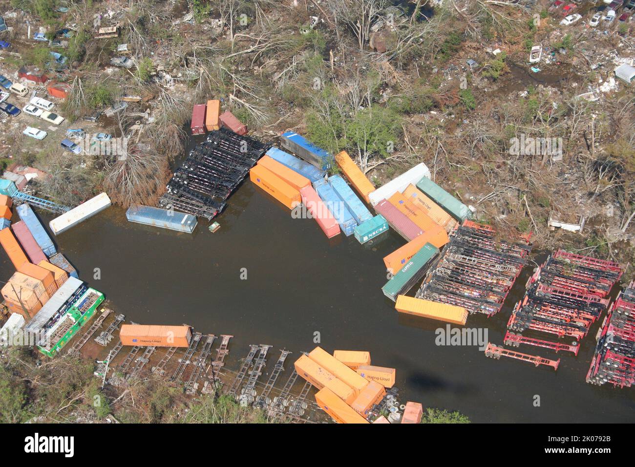
By the morning of Tuesday, August 30, the storm had moved inland and weakened into a tropical depression over Mississippi and Tennessee. However, the water in New Orleans continued to rise. Because the city sits below sea level, the breached levees acted like holes in a boat. Water continued to flow into the city until the water levels in the city equalized with the level of Lake Pontchartrain. It took weeks for the U.S. Army Corps of Engineers to "plug" the breaches and begin the massive operation of pumping the water back out.
Comparing Katrina to Other Major Louisiana Hurricanes
To understand the scale of when Katrina hit, it is helpful to compare its technical specifications with other major storms that have impacted Louisiana.
| Hurricane Name | Date of Landfall | Category at Landfall | Max Wind Speed (Landfall) | Minimum Pressure |
|---|---|---|---|---|
| Audrey | June 27, 1957 | Category 4 | 145 mph | 946 mbar |
| Camille | August 17, 1969 | Category 5 | 175 mph | 900 mbar |
| Andrew | August 26, 1992 | Category 3 (LA) | 115 mph | 956 mbar |
| Katrina | August 29, 2005 | Category 3 | 125 mph | 920 mbar |
| Rita | September 24, 2005 | Category 3 | 115 mph | 937 mbar |
| Ida | August 29, 2021 | Category 4 | 150 mph | 930 mbar |
Note: While Katrina was a Category 3 at landfall, its central pressure (920 mbar) was significantly lower than most Category 4 storms, which explains why its storm surge was so disproportionately large.
Regional Impacts: Beyond New Orleans
While New Orleans received the majority of the national media attention, the timing of Katrina’s landfall caused devastating impacts across a wide swath of Southern Louisiana.
Plaquemines and St. Bernard Parishes
Because these parishes sit at the "toe" of Louisiana, they were hit by the full force of the surge before the storm reached New Orleans. St. Bernard Parish saw nearly every single structure damaged or destroyed by a storm surge that exceeded 20 feet in some areas. In Plaquemines Parish, the surge overtopped levees on both the east and west banks of the Mississippi River, essentially wiping the communities of Empire and Buras off the map.
The Northshore (St. Tammany Parish)
As the storm moved toward its second landfall near the Pearl River, the communities of Slidell, Mandeville, and Madisonville faced the "dirty side" of the hurricane. The storm surge pushed Lake Pontchartrain into these coastal towns, destroying thousands of homes. The timing of this second landfall (around 10:00 AM) coincided with the peak surge, creating a localized catastrophe that was often overshadowed by the events in New Orleans.
Engineering and Safety: Why the Timing Mattered
The timing of Hurricane Katrina’s impact exposed critical flaws in the National Flood Insurance Program (NFIP) and the U.S. Army Corps of Engineers' design of the Southeast Louisiana Flood Control Project (SELA).
- Hydrostatic Pressure: The levees failed because they were not designed to handle the lateral pressure of the water. For years, it was believed the levees were "overtopped," but later forensic engineering reports confirmed that the foundations of the floodwalls were undermined by the pressure of the rising water hours before the water ever reached the top of the walls.
- Pump Failures: The drainage pumps in New Orleans are among the most powerful in the world, but they require electricity and staffed operators. As the storm hit on Monday morning, the power grid failed, and the pump stations themselves began to flood, leaving the city defenseless against the rising water.
- Communication Lag: Because the storm hit early on a Monday morning, many people who had not evacuated on Sunday were trapped in their homes. The rapid rise of water in the Lower Ninth Ward occurred so quickly that residents had to retreat to their attics and then use axes to break through to their roofs to avoid drowning.
Looking Back from 2026: The Legacy of August 29
As we observe the timeline of Hurricane Katrina from the perspective of 2026, the date August 29 has become a benchmark for disaster preparedness. The event led to the creation of the Hurricane and Storm Damage Risk Reduction System (HSDRRS), a $14 billion network of surge barriers, larger levees, and more robust pump stations designed to prevent a repeat of the 2005 failures.
The demographic shift triggered by the timing of the storm is still visible today. Thousands of "Katrina Exiles" who left Louisiana in late August 2005 never returned, permanently altering the populations of cities like Houston, Atlanta, and Baton Rouge. The recovery process was measured not in months, but in decades; even now, in 2026, some neighborhoods in the Lower Ninth Ward have not yet returned to their pre-2005 density.
Frequently Asked Questions
What day of the week did Katrina hit Louisiana?
Hurricane Katrina hit Louisiana on a Monday. This timing was significant because it followed a weekend where officials were frantically trying to implement a mandatory evacuation. The "Monday morning" landfall meant that rescue operations had to begin immediately in the middle of the work week, complicating the mobilization of the National Guard and federal resources.
Was Katrina a Category 5 when it hit Louisiana?
No, Hurricane Katrina was a Category 3 hurricane at the time of its Louisiana landfalls. However, it had been a Category 5 in the Gulf of Mexico just 12 hours prior. Because the storm was so large and had been so intense, it maintained a "Category 5 storm surge" even as its wind speeds decreased. This is why the damage was much greater than what is typically expected from a Category 3 storm.
How long did it take for New Orleans to flood after the storm hit?
The flooding began almost immediately upon landfall on Monday morning, August 29. Significant breaches in the Industrial Canal occurred before 9:00 AM. However, the city continued to fill with water throughout Monday night and into Tuesday, August 30. It was not until Wednesday, August 31, that the water levels finally stabilized, leaving 80% of the city submerged.
How many people died when Katrina hit Louisiana?
While the exact number is still debated due to the difficulty of tracking displaced persons, the generally accepted figure is that at least 1,833 people died as a result of Hurricane Katrina. The majority of these deaths occurred in Louisiana, primarily due to drowning following the levee breaches, rather than from the direct impact of the wind.
Where exactly did the eye of the storm make landfall?
The eye first made landfall in Buras-Triumph, Louisiana, which is located in Plaquemines Parish, approximately 60 miles south of New Orleans. The second landfall occurred near the mouth of the Pearl River, affecting both St. Tammany Parish, Louisiana, and Hancock County, Mississippi.
Practical Recommendations for Disaster History Research
For those researching the timeline of Hurricane Katrina for academic or insurance purposes, it is vital to consult original sources rather than relying on general news summaries. The National Hurricane Center's Tropical Cyclone Report on Katrina provides the most accurate, minute-by-minute meteorological data.
If you are looking for property-specific impact data, the FEMA Flood Map Service Center offers historical maps that show the extent of the 2005 inundation. For those interested in the engineering failures, the ASCE (American Society of Civil Engineers) report "The New Orleans Hurricane Protection System: What Went Wrong and Why" remains the definitive technical guide on the levee collapses.
Image Gallery
Select an image to open it in a new tab.

Simon Caldwell
Enterprise Technology and Systems Editor
