
While tropical systems from the Gulf of Mexico frequently track northward toward the United States, a true hurricane—defined by its sustained cyclonic winds and warm-core structure—has never struck Oklahoma. Due to its inland geography, significant elevation changes, and distance from maritime moisture sources, Oklahoma lacks the thermodynamic conditions required to sustain hurricane-force winds, making it essentially immune to these specific weather phenomena.
The Geographical and Climatological Barriers
To understand why hurricanes do not impact Oklahoma, one must first look at the mechanics of a tropical cyclone. A hurricane is an engine that feeds on the heat energy stored in deep, warm ocean waters. Once these systems move over land, they are deprived of their fuel source. As they travel further inland, they experience increased friction from terrain and, crucially, a loss of the latent heat release that keeps the eye wall intact.
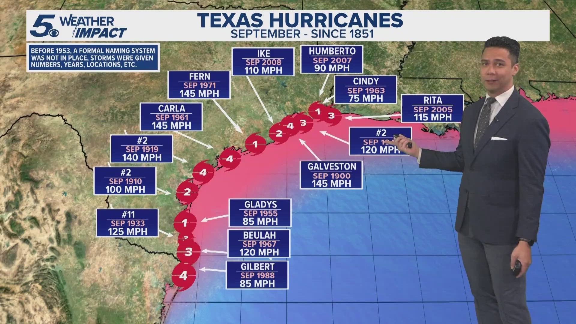
Oklahoma is located approximately 400 to 500 miles from the Gulf of Mexico. By the time any tropical depression or remnant low-pressure system reaches the Sooner State, it has already traversed the coastal plains of Texas and Louisiana. This journey forces the storm to shed its tropical characteristics. The wind shear, which is the change in wind speed and direction with height, often increases significantly as systems move inland, effectively tearing the organized circulation of a hurricane apart long before it can reach the Red River.
Tropical Remnants vs. Hurricanes
It is a common point of confusion for residents when they hear weather reports mentioning a "tropical system" or "remnants of a hurricane" impacting Oklahoma. It is vital to distinguish between a functioning hurricane and the extratropical remains of one.
When a hurricane makes landfall—for instance, near Galveston or Corpus Christi—the National Hurricane Center (NHC) begins the process of downgrading the system. As it moves over the continental landmass, it is reclassified as a tropical depression or a post-tropical cyclone. By the time these remnants reach Oklahoma, they are essentially massive, moisture-laden low-pressure systems.
These remnants can certainly cause severe weather in Oklahoma, including localized flooding, gusty winds, and even isolated tornadoes. However, these are fundamentally different from the sustained, destructive wind speeds of a Category 1 or higher hurricane. In Oklahoma, the primary weather threat is not the hurricane itself, but rather the atmospheric instability that these moist air masses introduce to a region already prone to dry-line interactions and extreme thermal gradients.
Thermodynamic Limitations and Wind Shear
The thermodynamic profile of Oklahoma is largely incompatible with the maintenance of a tropical cyclone. Hurricanes require a deep layer of moisture and a relatively uniform temperature profile to stay organized. Oklahoma’s climate is characterized by significant diurnal temperature swings and frequent interaction between polar air masses from the north and tropical air from the south.
Vertical wind shear is the primary "enemy" of a tropical cyclone. While shear can sometimes help ventilate a storm, excessive shear acts like a pair of scissors, slicing through the vertical structure of the storm and preventing it from stacking its low-level and high-level circulations. Oklahoma sits in a region where high-altitude jet streams frequently cross the plains. These winds create a hostile environment for the fragile, vertically aligned structure of a hurricane. If a hurricane were to approach, these atmospheric currents would likely cause the storm to tilt and dissipate rapidly.
Comparative Atmospheric Dynamics
| Feature | Tropical Cyclone (Hurricane) | Extratropical/Remnant Low |
|---|---|---|
| Primary Energy Source | Latent heat from warm ocean water | Baroclinic instability (temperature contrasts) |
| Wind Distribution | Strongest near the center | Strongest at high altitudes (jet stream level) |
| Structure | Warm-core symmetric circulation | Cold-core asymmetric system |
| Impact on Oklahoma | Impossible due to distance and friction | Occasional; leads to heavy rain and flooding |
The Role of Topography and Friction
The surface of the Earth exerts friction on moving air. Water is smooth, allowing winds to sustain high speeds with minimal resistance. Once a hurricane moves over the complex terrain of the southern United States, it encounters hills, forests, and man-made structures. This creates "surface roughness" that acts as a brake on the storm's circulation.
While Oklahoma’s terrain is not mountainous, the rolling hills and gradual elevation increase from east to west (moving toward the High Plains) provide enough frictional resistance to sap the remaining energy from a weakening tropical system. The moisture trapped within the storm is often forced up the gradual slope of the plains, causing orographic lifting. This is why remnants of tropical storms are famous for dumping high volumes of rainfall in eastern Oklahoma, even though they lack the wind intensity that defines a hurricane.
Historical Perspective and Misconceptions
Meteorological records in Oklahoma are extensive, and while there are many instances of heavy rainfall events tied to Gulf storms, none are classified as hurricane landfalls. When the media refers to a "hurricane" hitting Oklahoma, they are almost exclusively describing a high-impact rain event or a period of severe weather exacerbated by tropical moisture.
Public perception is often shaped by the widespread destruction caused by tornadoes, which are frequent in Oklahoma. Because both hurricanes and tornadoes are associated with extreme wind, the two are sometimes conflated in the public imagination. However, the mechanism of a tornado—a small, intense vortex born from supercell thunderstorms—is completely different from the massive, synoptic-scale rotation of a hurricane. Oklahoma is arguably the world’s center for tornado activity, but this is a function of the region's unique collision of air masses, not tropical cyclone activity.
Managing Weather Risks in Oklahoma
Even though hurricanes do not strike the state, the risk from tropical moisture remains a tangible factor for emergency management. The following table summarizes how to distinguish and prepare for these varied risks:
| Risk Factor | Source | Primary Hazard | Mitigation Strategy |
|---|---|---|---|
| Hurricane Remnants | Tropical Systems | Inland Flooding | Monitor flash flood warnings |
| Tornadoes | Supercells | Extreme Wind | Maintain a designated storm shelter |
| Severe Thunderstorms | Cold Fronts | Hail/Wind/Lightning | Secure outdoor property |
Frequently Asked Questions
Can a hurricane ever move far enough inland to hit Oklahoma as a hurricane?
No. The energy required to maintain a hurricane is so vast that the transition from ocean to land triggers a rapid decay. Even the most powerful storms, such as Hurricane Harvey (2017), lost their tropical wind classification long before reaching the Oklahoma state line, despite their massive size and moisture content.
What is the most severe impact I might see from a tropical storm in Oklahoma?
The most significant impact is almost always extreme, widespread rainfall. These systems can drop several inches of rain in a short period, leading to flash flooding in low-lying areas and the overflowing of drainage systems and regional rivers.
Why do weather reports sometimes sound like a hurricane is coming to Oklahoma?
Weather forecasters use standardized language regarding "tropical moisture" or "remnants." If a report mentions a storm coming from the Gulf, it is often to warn the public about increased rainfall and the potential for secondary hazards like increased tornado probability, which can occur when tropical moisture interacts with Oklahoma's volatile spring or autumn atmosphere.
Does Oklahoma need to carry hurricane insurance?
Standard homeowners insurance policies in Oklahoma do not provide "hurricane insurance" because hurricanes do not occur there. However, standard policies typically cover wind damage from thunderstorms. It is essential to check if your policy covers wind and hail separately and to strongly consider a standalone flood insurance policy if you live in a low-lying area, as tropical remnant flooding is a legitimate risk.
Is climate change going to make hurricanes reach Oklahoma?
While climate change is leading to warmer Gulf surface temperatures and more intense storms at landfall, the fundamental physical laws governing tropical cyclones—specifically their need for a direct, warm-water energy source—remain unchanged. The distance between the Gulf and Oklahoma remains a static, insurmountable obstacle for the survival of a tropical cyclone’s core structure.
Practical Next Steps for Residents
If you are concerned about extreme weather in Oklahoma, shift your focus from hurricane preparation to flooding and severe convective storm safety.
- Verify Your Flood Status: Visit the Federal Emergency Management Agency (FEMA) Flood Map Service Center to determine if your property is located in a high-risk flood zone.
- Review Your Insurance: Contact your provider to confirm what "wind and hail" coverage is included in your policy. Ensure you understand the distinction between general wind damage and flood damage, which typically requires a separate policy.
- Emergency Preparedness: Because Oklahoma is prone to rapid weather changes, always maintain a "go-bag" and a weather radio. Ensure your home has a reinforced "safe room" or a clear plan to access a reinforced storm shelter during severe convective wind events, which are a much more frequent reality for the state than tropical cyclones.
Image Gallery
Select an image to open it in a new tab.
Mateo Castillo
Decentralized Finance and E-Payments Strategist
