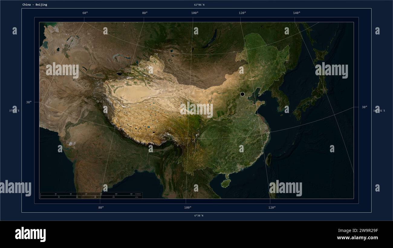
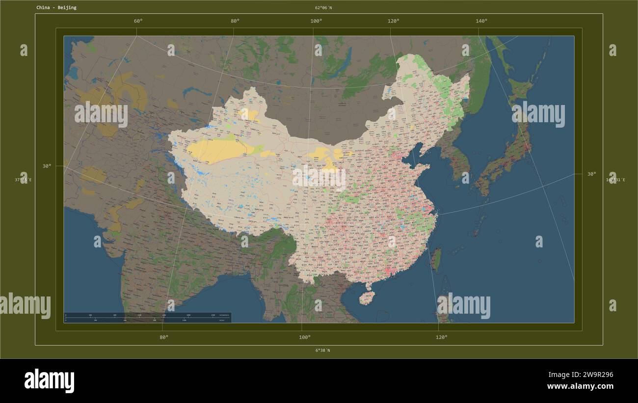
The distance across China depends entirely on the orientation of the measurement, as the country spans approximately 5,000 kilometers (3,107 miles) from east to west and about 5,500 kilometers (3,418 miles) from north to south. Because of its massive land area—the third or fourth largest in the world depending on measurement criteria—simple linear estimates vary based on the specific points chosen within its borders.
Understanding the scale of China requires looking beyond a single number. Stretching from the Pamir Mountains in the west to the confluence of the Amur and Ussuri rivers in the east, and from the northern reaches near Mohe to the southern islands of the South China Sea, China’s geography encompasses diverse climate zones, extreme elevations, and varied administrative regions.
Defining Geographical Extremes
To provide an accurate answer regarding the distance across China, one must differentiate between the longitudinal (east-west) and latitudinal (north-south) spans. The sheer size of the People's Republic of China means that it covers five distinct geographical time zones, although the nation officially operates on a single standard time: Beijing Time (UTC+8).
The East-West Span
The maximum east-west distance of China is roughly 5,000 kilometers (3,107 miles). This measurement captures the width from the westernmost point in Xinjiang, near the border with Tajikistan, to the easternmost point in Heilongjiang province.
This vast horizontal stretch crosses the entirety of the Central Asian plateau, moving through the Gobi Desert, the loess plateaus, the central plains, and finally to the coastal regions bordering the Yellow and East China Seas. Because of this span, the solar time across the country can vary by over four hours, creating significant differences in daylight hours between the western provinces and the eastern seaboard.
The North-South Span
The north-south distance is generally cited as approximately 5,500 kilometers (3,418 miles). This vertical span encompasses the distance from the Heilongjiang province border with Russia in the north to the southernmost reaches of the South China Sea.
This journey covers an extraordinary range of latitudes. In the north, the climate is subarctic, characterized by long, severe winters and short summers. As one moves south, the geography shifts through temperate zones into subtropical regions and finally to the tropical islands of Hainan and the archipelagos further south. The contrast in ecosystems—from the boreal forests of the north to the tropical rainforests and mangroves of the south—is a direct result of this massive latitudinal stretch.
Measurement Methodology and Geographic Constraints
Calculating "the distance" across a country as irregular as China involves more than drawing a straight line on a map. Cartographers and geographers use geodesic distance, which accounts for the curvature of the Earth rather than flat-plane Euclidean geometry.
When discussing these distances, it is essential to consider the following variables:
- The Projection Bias: Depending on the map projection used (such as Mercator or Gall-Peters), distances can appear distorted, particularly at higher latitudes.
- Boundary Precision: China shares land borders with 14 different countries. Determining the exact "edge" of the country depends on international agreements and the specific demarcation of border lines, particularly in disputed territories.
- The "Straight Line" Reality: A straight line from east to west or north to south may cross impassable terrain, such as the Himalayas or the Taklamakan Desert. Therefore, travel distance—the path one would take by road, rail, or air—is significantly longer than the direct geodesic distance.
Comparison of National Dimensions
To provide context, comparing China’s span to other large nations helps visualize the scale. While the United States and Canada share similar land area profiles, the shape of the landmass creates different travel experiences.
| Country | Approximate East-West Span | Approximate North-South Span |
|---|---|---|
| China | 5,000 km (3,107 miles) | 5,500 km (3,418 miles) |
| United States | 4,500 km (2,800 miles) | 2,500 km (1,550 miles) |
| Russia | 9,000 km (5,600 miles) | 4,000 km (2,500 miles) |
| Australia | 4,000 km (2,485 miles) | 3,700 km (2,300 miles) |
Note: Data reflects approximate continental spans and is subject to variances based on the specific points used for measurement.
The Impact of Scale on Transportation and Infrastructure
The distance across China is not merely a theoretical statistic; it is a fundamental driver of the nation’s infrastructure development. In 2026, China maintains one of the world's most extensive high-speed rail networks, designed specifically to bridge these massive distances.
Rail Connectivity
The high-speed rail network has transformed the "distance" from a physical barrier into a logistical variable. Journeys that once took days by traditional train or weeks by road are now possible in hours. The main arteries—such as the Beijing-Shanghai and Beijing-Guangzhou lines—serve as the backbone for moving millions of people across thousands of kilometers.
Road and Air Travel
Despite the efficiency of rail, the vast distance necessitates a robust aviation sector. Major hubs in Shanghai, Beijing, Guangzhou, and Chengdu act as central nodes. For cargo, the "Belt and Road" infrastructure initiatives have emphasized the importance of road and rail corridors that span the full east-west breadth, connecting the interior of China to international markets.
Challenges of Extreme Geographical Diversity
The primary challenge of governing such a vast territory is the uneven distribution of resources, population, and climate. The eastern third of China contains the vast majority of the population, leading to intense urbanization. Conversely, the western regions—comprising Tibet, Xinjiang, and Inner Mongolia—are sparsely populated, characterized by high-altitude plateaus and arid deserts.
Environmental Variability
The distance across China creates a "climatological gradient." For instance, a traveler moving from east to west experiences a progressive decline in humidity and an increase in altitude. This dictates everything from agriculture (rice in the south and east, wheat and livestock in the north and west) to architecture and energy consumption patterns.
Administrative Coordination
Managing a country that spans thousands of kilometers necessitates highly decentralized regional administration. While the central government in Beijing sets national policy, the execution of these policies must account for local environmental realities—such as the need for heating infrastructure in the north versus flood management systems in the southern river deltas.
Frequently Asked Questions
Why is there only one time zone for such a huge distance? China officially uses Beijing Time (UTC+8) for the entire country to promote national unity and standardized administration. While this simplifies logistics, it results in "social time" differences; in western regions like Xinjiang, the sun may not set until very late in the evening, leading some local communities to unofficially observe "Xinjiang Time" (UTC+6) to better align with the solar cycle.
Does the distance across China include maritime territories? Geographical measurements of China's landmass typically focus on the continental territory. However, China claims a significant area within the South China Sea, which extends the country's reach far beyond the mainland’s southern coast. When including these maritime claims, the "total" distance from the northernmost point to the southernmost tip of the claimed maritime zones is even greater.
How long does it take to travel across China? By high-speed train, traveling from Beijing to the far south (e.g., Guangzhou or Hong Kong) takes approximately 8 to 10 hours. Traveling from east to west is significantly more complex due to the terrain; a cross-country journey could take multiple days depending on whether one is utilizing high-speed rail, regional road networks, or domestic air travel.
Is the distance increasing due to geological shifts? The physical landmass of China is subject to tectonic movement. The collision of the Indian Plate with the Eurasian Plate continues to drive the uplift of the Himalayas and the Tibetan Plateau. While this geological activity changes the elevation and local geography, it does not meaningfully change the overall distance across the country on a human timeframe.
What is the most difficult region to traverse? The western regions—specifically the Qinghai-Tibet Plateau and the Taklamakan Desert—are the most challenging to traverse. These areas feature extreme altitudes, oxygen-thin air, and harsh, unpredictable weather, which have historically limited infrastructure development compared to the coastal plains of the east.
Conclusion and Practical Perspective
When researching the distance across China, it is most practical to view the country through its distinct geographical zones rather than a singular linear measurement. Whether planning logistics, studying demographics, or conducting research, recognize that the 5,000-to-5,500-kilometer span represents an immense diversity of environment, culture, and climate. For those traveling or moving goods, the most critical factor is not the direct distance but the transit network—high-speed rail, air, and highway infrastructure—that has been specifically engineered to overcome these expansive physical dimensions.

Image Gallery
Select an image to open it in a new tab.



Akira Tanaka
International Academic Trends Correspondent
