Understanding the Israeli-Palestinian Map and Territorial Boundaries
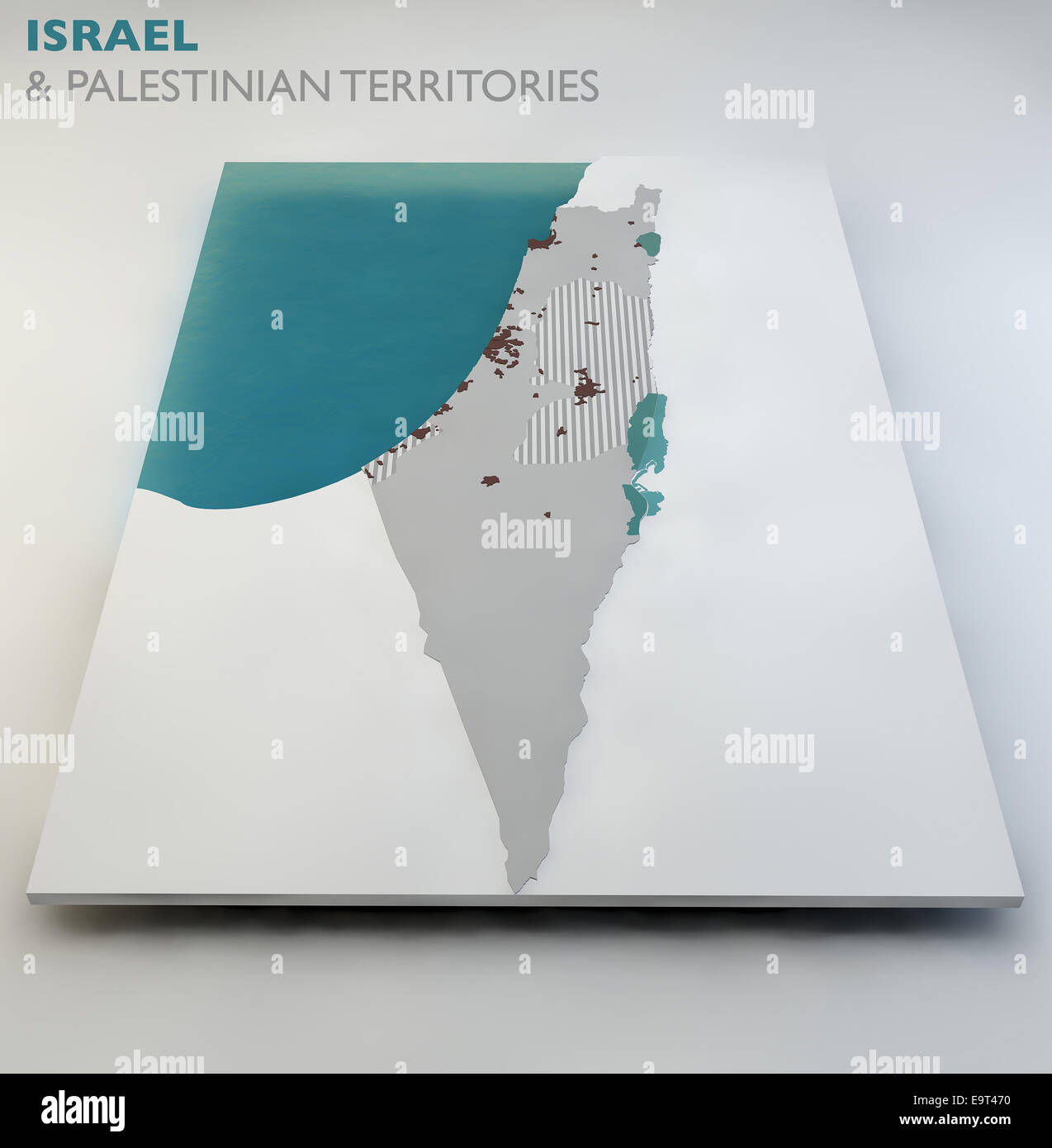
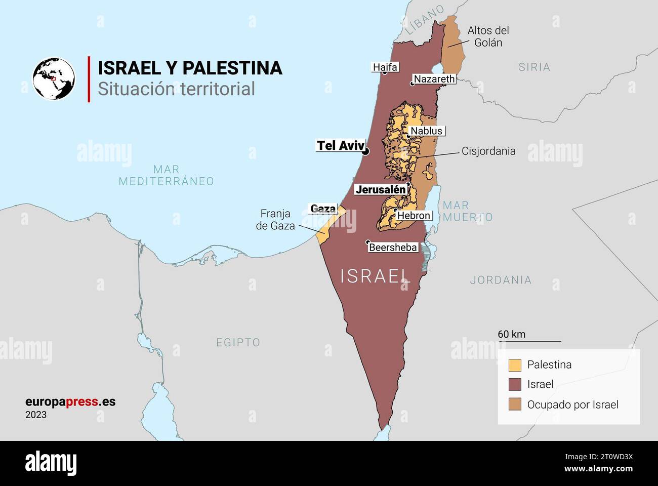
The Israeli-Palestinian map comprises a complex configuration of disputed territories, internationally recognized borders, administrative divisions, and military zones that have evolved through decades of conflict, diplomacy, and geopolitical shifts. At its core, the territory encompasses the land between the Jordan River and the Mediterranean Sea, historically referred to as Mandatory Palestine, which today includes the State of Israel, the West Bank (including East Jerusalem), and the Gaza Strip. Comprehending this geography requires examining historical demarcation lines, administrative agreements, and the physical barriers that shape contemporary access and governance.
Historical Foundations of the Map: The 1948 Armistice and 1967 Lines
To understand any modern depiction of the Israeli-Palestinian map territories, one must begin with the legacy of the 1948 Arab-Israeli War and the subsequent 1949 Armistice Agreements. The cease-fire lines established during these negotiations formed what is widely known as the Green Line.
The Green Line served as the de facto boundary between Israel and the neighboring Arab states, placing the West Bank under Jordanian administration and the Gaza Strip under Egyptian administration. For nearly two decades, this cartographic separation defined the region's political geography. However, the 1967 Six-Day War radically transformed the map. During this conflict, Israel captured the West Bank from Jordan, the Gaza Strip from Egypt, East Jerusalem, the Golan Heights from Syria, and the Sinai Peninsula (which was later returned to Egypt under the 1979 peace treaty).
The capture of the West Bank and Gaza Strip brought millions of Palestinians under Israeli military occupation, introducing a new layer of territorial administration. International bodies, including the United Nations Security Council through Resolution 242, emphasized the impermissibility of acquiring territory by war and called for Israeli withdrawal from territories occupied in the conflict, framing the legal status of the West Bank and Gaza Strip as occupied territories under international humanitarian law.
The Oslo Accords and Administrative Divisions in the West Bank
The modern administrative layout of the West Bank is largely defined by the Oslo Accords, signed by the Government of Israel and the Palestine Liberation Organization (PLO) in the 1990s. The interim agreements introduced a system of territorial categorization designed to facilitate a gradual transfer of authority to the newly established Palestinian Authority (PA).
The West Bank was divided into three distinct administrative and security zones:
- Area A: Comprising major Palestinian urban centers, Area A initially covered roughly 3% of the West Bank, though subsequent agreements expanded this figure. In this zone, the Palestinian Authority holds responsibility for both internal security and civil administration.
- Area B: Comprising many Palestinian rural areas and smaller towns, Area B covers approximately 20 to 22 percent of the West Bank. Here, the Palestinian Authority manages civil administration, while joint Israeli-Palestinian security control or primary security dominance is maintained by Israel.
- Area C: Covering roughly 60% of the West Bank, Area C encompasses rural expanses, agricultural lands, natural resources, and Israeli settlements. In Area C, Israel retains full control over security, defense, and land planning, including zoning and construction permits.
This patchwork fragmentation means that the West Bank does not appear as a continuous, unified territory on a map. Instead, it features numerous non-contiguous enclaves separated by checkpoints, bypass roads, and security infrastructure, presenting significant logistical challenges for local freedom of movement and economic development.
Israeli Settlements and Infrastructure
A central feature of the modern West Bank map is the presence of Israeli settlements and associated infrastructure. Following 1967, successive Israeli governments established civilian communities across the West Bank and East Jerusalem.
Under international law, specifically the Fourth Geneva Convention regarding occupied territories, the establishment of settlements is widely viewed by the international community as illegal. The International Court of Justice (ICJ) and the United Nations have repeatedly affirmed this stance. Conversely, the Israeli government disputes this legal interpretation, arguing that the territory was not under the legitimate sovereignty of any state prior to 1967 and that historical and security claims justify the communities.
These settlements range from small rural outposts to large municipal urban centers, such as Modi'in Illit, Ma'ale Adumim, and Ariel, which house hundreds of thousands of residents. The map of these settlements is interconnected by a complex grid of regional highways, bypass roads restricted or prioritized for Israeli civilian and military use, and security perimeters that further segment Palestinian communities from one another.
The Separation Barrier (West Bank Wall/Fence)
Construction of the West Bank separation barrier began in the early 2000s, following a wave of violence during the Second Intifada. The Israeli government maintained that the physical barrier—consisting of concrete walls in urban areas and multi-layered electronic fences, trenches, and patrol roads in rural areas—was a necessary security measure to prevent infiltration by attackers.
On the map, the barrier frequently deviates significantly to the east of the Green Line to encompass major settlement blocs within the Israeli side. This deviation has resulted in the creation of a "seam zone" between the barrier and the Green Line, isolating thousands of Palestinian landowners from their agricultural fields and restricting access to urban centers. The International Court of Justice issued an advisory opinion in 2004 finding parts of the barrier built on occupied territory to be contrary to international law, a ruling rejected by the Israeli government, which emphasizes the barrier's security rationale.
The Gaza Strip: Geographic Isolation and Disengagement
The Gaza Strip represents a geographically distinct and intensely densely populated territory on the Mediterranean coast. Bordered by Israel to the east and north, Egypt to the southwest, and the sea to the west, Gaza measures approximately 41 kilometers in length and between 6 and 12 kilometers in width.
For decades following 1967, the Gaza Strip contained numerous Israeli settlements alongside Palestinian population centers. However, in 2005, the Israeli government executed its unilateral disengagement plan, evacuating all Israeli military forces and civilian settlements from the territory.
Following the Hamas victory in the 2006 legislative elections and its subsequent takeover of governance in Gaza in 2007, Israel—in coordination with Egypt—imposed a comprehensive land, air, and sea blockade. Cartographically, Gaza is isolated from the West Bank, with no open transit corridor connecting the two Palestinian territories. The maritime boundaries and airspace of Gaza remain entirely under Israeli control, and land crossings are heavily restricted and monitored.
Jerusalem: The Contested Capital
Jerusalem occupies a uniquely contentious position on the Israeli-Palestinian map. Following the 1948 war, the city was divided, with West Jerusalem under Israeli control and East Jerusalem (including the Old City and holy sites sacred to Judaism, Christianity, and Islam) under Jordanian control.
In 1967, Israel captured East Jerusalem and subsequently applied Israeli law, administration, and jurisdiction to the entire city, effectively annexing East Jerusalem—a move not recognized by the international community, which views East Jerusalem as occupied territory. Israel considers the entirety of Jerusalem its undivided and eternal capital. Conversely, Palestinian leadership envisions East Jerusalem as the capital of a future Palestinian state. Maps published by international organizations typically designate East Jerusalem separately from Israel proper, while official Israeli maps depict the municipal boundaries of the unified city.
Comparison of Territorial Designations in the West Bank and Gaza
| Territory / Zone | Governance & Administration | Security Control | International / Legal Status |
|---|---|---|---|
| Area A (West Bank) | Palestinian Authority (Civil & Internal Security) | Palestinian Authority | Occupied territory under international consensus |
| Area B (West Bank) | Palestinian Authority (Civil) | Joint / Israeli Dominance | Occupied territory under international consensus |
| Area C (West Bank) | Israeli Civil Administration | Israeli Military | Occupied territory; locus of Israeli settlements |
| East Jerusalem | Israeli Municipal / Annexed | Israeli Security | Disputed territory / Occupied under international law |
| Gaza Strip | De facto Hamas administration | Blockaded / Controlled externally by Israel and Egypt | Occupied territory under international consensus |
Frequently Asked Questions
What is the Green Line?
The Green Line is the 1949 armistice border established between Israel and its neighbors (Jordan, Egypt, Syria, and Lebanon) following the 1948 Arab-Israeli War. It served as the recognized de facto boundary until the 1967 Six-Day War and remains the baseline reference point for most international peace proposals and two-state solutions.
Why is the West Bank divided into Areas A, B, and C?
These zones were established under the 1995 Oslo II Accord as an interim administrative arrangement intended to transfer incremental governance responsibilities to the Palestinian Authority while maintaining Israeli security oversight over borders, regional security, and Israeli settlements during a transition period.
Are Israeli settlements legal under international law?
Most of the international community, the United Nations Security Council, and the International Court of Justice consider Israeli settlements in the West Bank and East Jerusalem to be illegal under the Fourth Geneva Convention, which prohibits an occupying power from transferring its civilian population into occupied territory. The Israeli government rejects this interpretation, citing historical, legal, and security arguments.
Is there a geographic connection between the West Bank and the Gaza Strip?
No physical corridor connects the West Bank and the Gaza Strip. They are separated by Israeli sovereign territory spanning roughly 40 kilometers at their closest points. The Oslo Accords discussed a "safe passage" route, but it was never permanently implemented, leaving the two territories geographically and politically fragmented.
How do official Israeli maps differ from international maps of the region?
International maps typically delineate the Green Line, mark East Jerusalem and the West Bank as territories occupied in 1967, and outline the Gaza Strip separately. Official Israeli government maps often omit the Green Line within the context of sovereign Israel, reflect the municipal boundaries of unified Jerusalem, and may use different terminology for the West Bank, referring to the region historically and biblically as Judea and Samaria.
Next Actions for Further Study
To deepen your understanding of the geography and geopolitical dynamics, consult primary documents such as United Nations Security Council Resolution 242 and the Oslo Accords text. Additionally, examine GIS mapping resources and reports from independent monitoring organizations such as the United Nations Office for the Coordination of Humanitarian Affairs (UNOCHA) for detailed spatial analysis of territorial fragmentation and access restrictions.
Image Gallery
Select an image to open it in a new tab.


Zara El-Hashem
Sociocultural Dynamics and Academics Writer
